

A Winter Weather Advisory is in effect for Fond du Lac, Ozaukee, Dodge, and Washington Counties from midnight Thursday night until 6:00 a.m. Saturday.
A cold front moved in overnight and shifted the wind to the northwest, but temps are still in the 40s and lower 50s to start the day, but temps will slowly drop throughout the day.
- SEVERE WEATHER TOOLS: CLOSINGS | SnowCast | Phone Alerts
It will be cloudy and breezy all day with temps in the upper 30s by 4pm, and rain showers develop by evening and continue overnight with lows in the 30s. There will be a few areas of sleet and snow in the inland areas overnight, and the NE wind will gust to 35 mph.
Friday is cloudy, foggy and breezy, with rain likely and a few thundershowers with highs in the lower 40s and a NE wind to 20 mph. The rain changes to snow Friday night into Saturday morning with 1-2” of accumulation.
Saturday remains cloudy and windy with highs near freezing (normal), and wind chills will be in the teens due to winds gusting to 30 mph. Sunday is partly cloudy with flurries highs in the mid 30s.
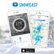 Be sure and try our new SNOWCAST APP! It is the "snow equivalent to STORM SHIELD" - a great new product that gives you high resolution snow forecasts for any part of the nation! It has just been introduced for iPhones, but we are working on the Android version! Just search SNOWCAST in the App Store or SNOWCAST APP! It is the "snow equivalent to STORM SHIELD" - a great new product that gives you high resolution snow forecasts for any part of the nation! It has just been introduced for iPhones, but we are working on the Android version! Just search SNOWCAST in the App Store or click here.
