


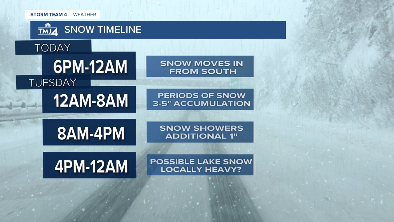
SE WISCONSIN — A winter storm arriving Monday evening could bring several inches of snow to some in Southeast Wisconsin.
The storm is expected to arrive after 6 p.m., with snow moving into the area from the south.
A winter weather advisory has been issued for several counties in SE Wisconsin, including Sheboygan, Washington, Ozaukee, Jefferson, Waukesha, Milwaukee, Walworth, Racine and Kenosha counties. The advisory goes into effect at 6 p.m. Monday through 6 p.m. Tuesday.
Milwaukee Metro could see anywhere from 4 to 6-inches of snow with heavier amounts along the lakeshore. Lighter snow accumulation is expected north and west of Milwaukee.
Areas near and south of Kenosha could see more than 6 inches.

Additional lake effect snow could affect snow totals tomorrow afternoon and evening.
Monitor conditions in your area by clicking here.
