

It will be cold again overnight with lows falling to near 10° by the lake and single digits inland. Skies will be mainly clear to partly cloudy overnight with light winds. Friday we warm back into the upper 20s under partly to mostly cloudy skies. A few isolated lake effect snow flurries will be possible late in the day. Friday night into Saturday morning is not as cold; lows will remain in the teens and low 20s.
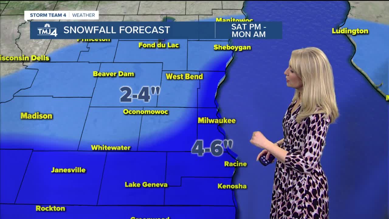
Saturday will be dry during the daytime hours with mostly cloudy skies. It will be windy with gusts up to 30 mph. Snow moves in late Saturday night and continues into much of the day Sunday. Sunday is another windy day with gusts up to 40 mph. The combination of wind and snow will cause blowing snow and reduced visibility on the roads. Large waves will build on Lake Michigan as well, and due to the onshore wind direction, there may be some lakeshore flooding and erosion. Snow will be heavy at times, and an early look at snow totals suggest much of the area could see 3-6" of new snow. There will also be an added lake effect snow component, which could boost totals near the lakeshore. Again, Saturday during the day will be dry for weekend plans, but any plans Sunday could be significantly impacted by the snow.
A few snow showers may linger into early Monday. Otherwise, Monday-Wednesday looks mainly dry with some sunshine. Our next system looks like it arrives Wednesday night into Thursday.
TONIGHT: Mostly clear to partly cloudy
Low: 10 Lake Inland 0
Wind: N 5-10 mph
FRIDAY: Partly to mostly cloudy
High: 28
Wind: SE 5-15 mph
SATURDAY: Mostly cloudy, windy, snow late
High: 33
SUNDAY: Accumulating snow, windy
High: 31
MONDAY: Scattered AM snow, partly cloudy, breezy
High: 29
TUESDAY: Partly cloudy
High: 32
