

It was another mild December day, with highs near 40 despite clouds moving back in this afternoon.
As a storm system gets closer to us tonight, the southerly wind increases to 30 mph and keeps our overnight temps warm with lows in the upper 30s...that is almost 10 degrees warmer than our normal highs.
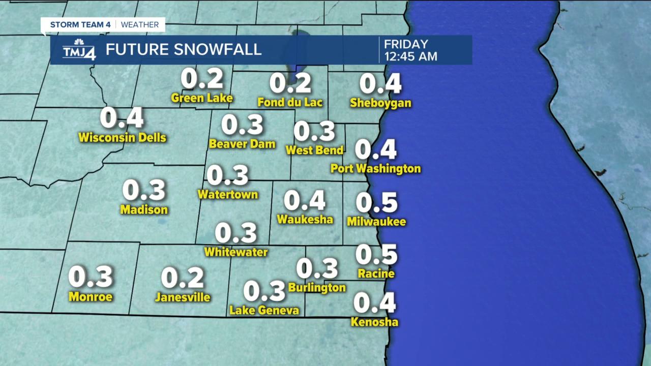
With the warm start, Wednesday is a mild day with highs near 50 thanks to a southerly wind gusting 30 to 40 mph. It will be a dreary day with scattered light rain by late afternoon along a cold front. The wind shifts to the NW and temps drop quickly in the evening with some light snow. Any accumulation will be a dusting, but the temps are the big story.
Thursday is mostly cloudy and windy with gusts to 30mph, temps in the teens and wind chills near 0 all day. Christmas morning is in the single digits with wind chills to -10 in Milwaukee to -20 inland. Friday afternoon has a few clouds with some flurries and a cold wind keeping highs near 20 and wind chills near 20. Saturday is nice with sun, a light breeze and temps near 30. We are watching a system that will bring snow showers to our area by Sunday afternoon into Monday....stay tuned.
TONIGHT: Mostly cloudy, windy and mild
Low 37
Wind: S 15-30 mph
WEDNESDAY: Cloudy, windy and mild with afternoon light rain changing to light snow by evening
High: 50
Wind: SSW 20-35 gusts to 40 mph
THURSDAY: Partly cloudy, windy and cold
Wind chills near 0 all day
High: 17
Wind: NW 15-30 mph
FRIDAY: Partly cloudy, windy and cold with flurries
High: 21
Wind: NW 15-25 mph
SATURDAY: Mostly sunny and pleasant
High: 32
Wind: SW 5-10 mph
SUNDAY: Cloudy and breezy with afternoon snow
High: 34
Wind: SE 10-20 mph
