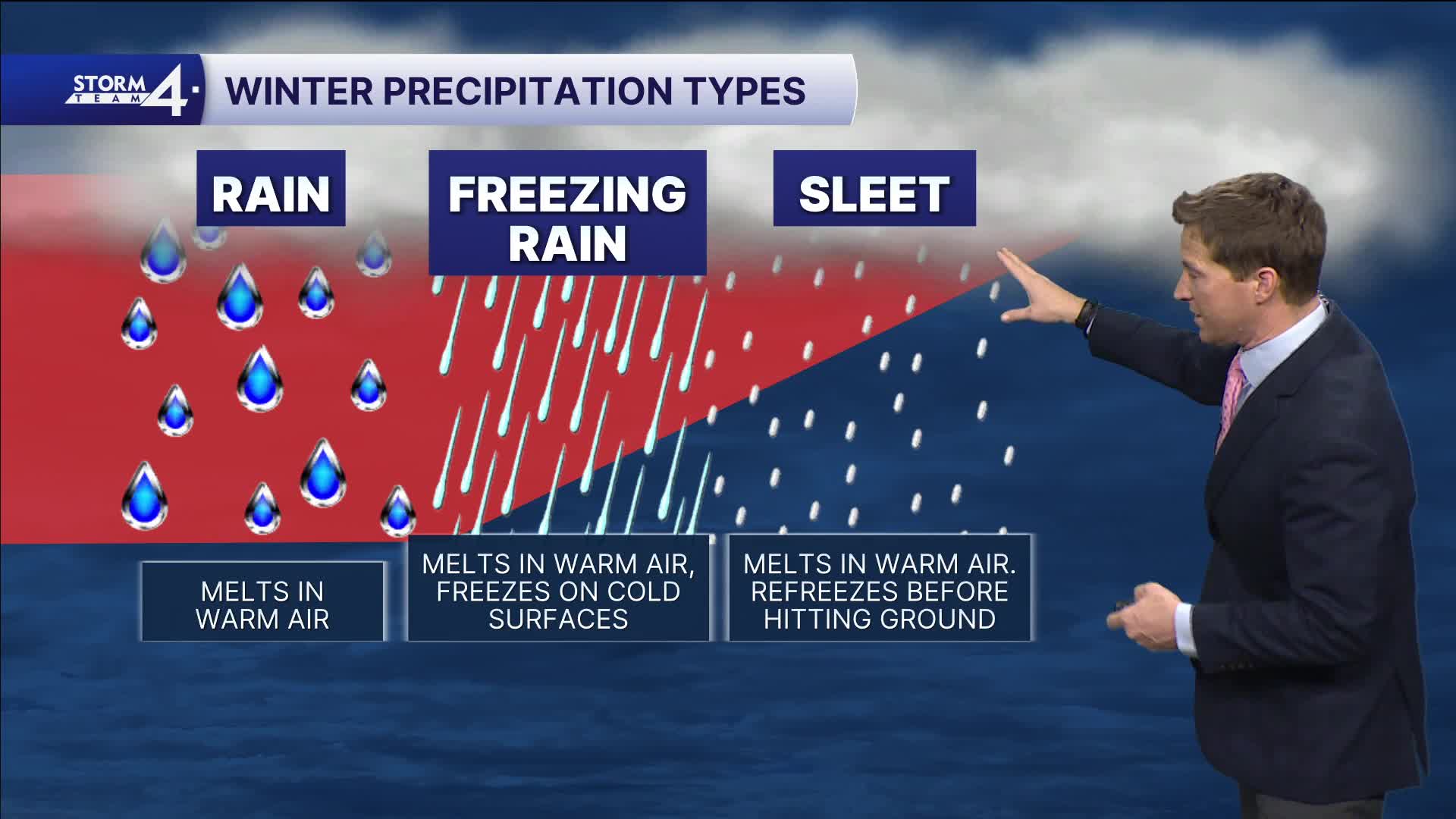


We're watching an area of rain, sleet, and snow showers drop down from northern Minnesota. Some computer models track this action into southeastern Wisconsin later tonight. Our column of air may be supportive of freezing rain, with temperatures right around freezing at the surface.
Major icing isn't expected, but some slippery spots are possible late this evening through early tomorrow morning.
WATCH: Southeastern Wisconsin weather: Showers and warmer temperatures
The rest of the week looks quiet as we also slowly melt away our snow. Some 50s are possible on Friday, especially away from Lake Michigan, and everyone has a chance for 60 on Saturday!
TONIGHT: Ch. Mix/Frz. Rain.
Low: 31
Wind: Calm
THURSDAY: AM Patchy Fog. Partly Cloudy
High: 42
Wind: E 5 mph
FRIDAY: Mostly Cloudy
High: 47 Lake 53 Inland
SATURDAY: Partly Cloudy, Breezy, Mild
High: 62
SUNDAY: Chance Mix
High: 41
It’s about time to watch on your time. Stream local news and weather 24/7 by searching for “TMJ4” on your device.
Available for download on Roku, Apple TV, Amazon Fire TV, and more.
