

We have our first, major snow event of the season on the way Saturday into Saturday night.
The earlier you can get things done out and about on Saturday, the better off you're going to be.
The day is here! The big snow event we have been watching and waiting for.
Storm Team 4 has been monitoring this impactful winter storm all week. A Winter Storm Warning is still in effect until 6A Sunday morning.
Given the long duration of this event and the potential for higher snowfall rates, the Storm Team 4 snowfall forecast has been increased to 8-11" for most of SE Wisconsin. There is an opportunity for locally higher amounts farther SW — closer to an axis of heavier snowfall.
Watch the forecast here:
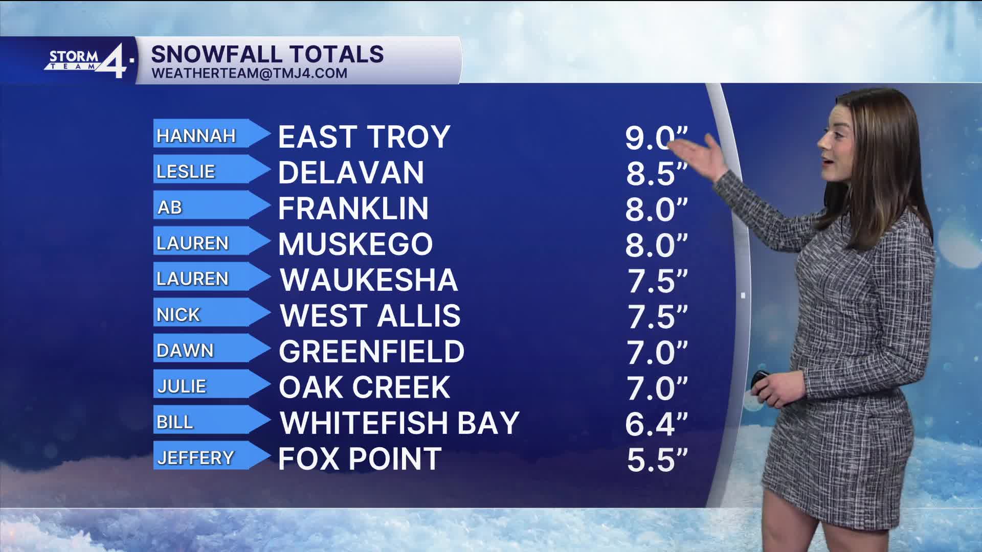
We have been watching these snowflakes fall all day. Accumulations are only a few inches this afternoon.
As we continue into the evening, conditions will deteriorate, and snowfall rates reach 1/2"-1" per hour. We still are not recommending travel.
Low visibility combined with accumulation on roadways will make for slick & slippery pavement. Snow showers are sticking around Sunday morning. Low pressure moves to the east and leaves us with some gusty winds on Sunday. Falling snow is not expected on Sunday afternoon, but we may still see blowing and drifting snow.
It's recommended that snow be cleared as soon as the event ends because it may harden as bitter cold sets in early next week. Overnight lows will tumble into the single digits. Highs will run in the 20s which is 20° below average.
****WINTER STORM WARNING FOR ALL OF SE WISCONSIN EARLY SATURDAY - 6A SUNDAY****
SATURDAY: Snow slowly getting heavier as the day wears on.
Becomng breezy with a daytime accumulation: 4-6"
High: 33.
Wind: SE 6-12 gusting over 20 MPH this afternoon.
SATURDAY NIGHT: Breezy with snow slowly tapering off through the overnight.
Another 4-5" bringing STORM TOTALS OF 8-11" by early morning Sunday.
Low: 28.
Wind: Bec. NW 6-12 gusting to 25 MPH.
SUNDAY: Blustery, with any snow showers tapering off and some blowing snow in some areas.
Some afternoon sun.
High: 32 and falling into the mid 20s through the afternoon.
Wind: NW 10-20 gusting to 30 MPH.
SUNDAY NIGHT: Cold with a few clouds.
Low: 12.
MONDAY: Mostly cloudy with a chance of a little light afternoon snow.
High: 26.
TUESDAY: Partly cloudy.
High: 25.
WEDNESDAY: Mostly cloudy with a chance of light snow.
High: 33.
It’s about time to watch on your time. Stream local news and weather 24/7 by searching for “TMJ4” on your device.
Available for download on Roku, Apple TV, Amazon Fire TV, and more.
