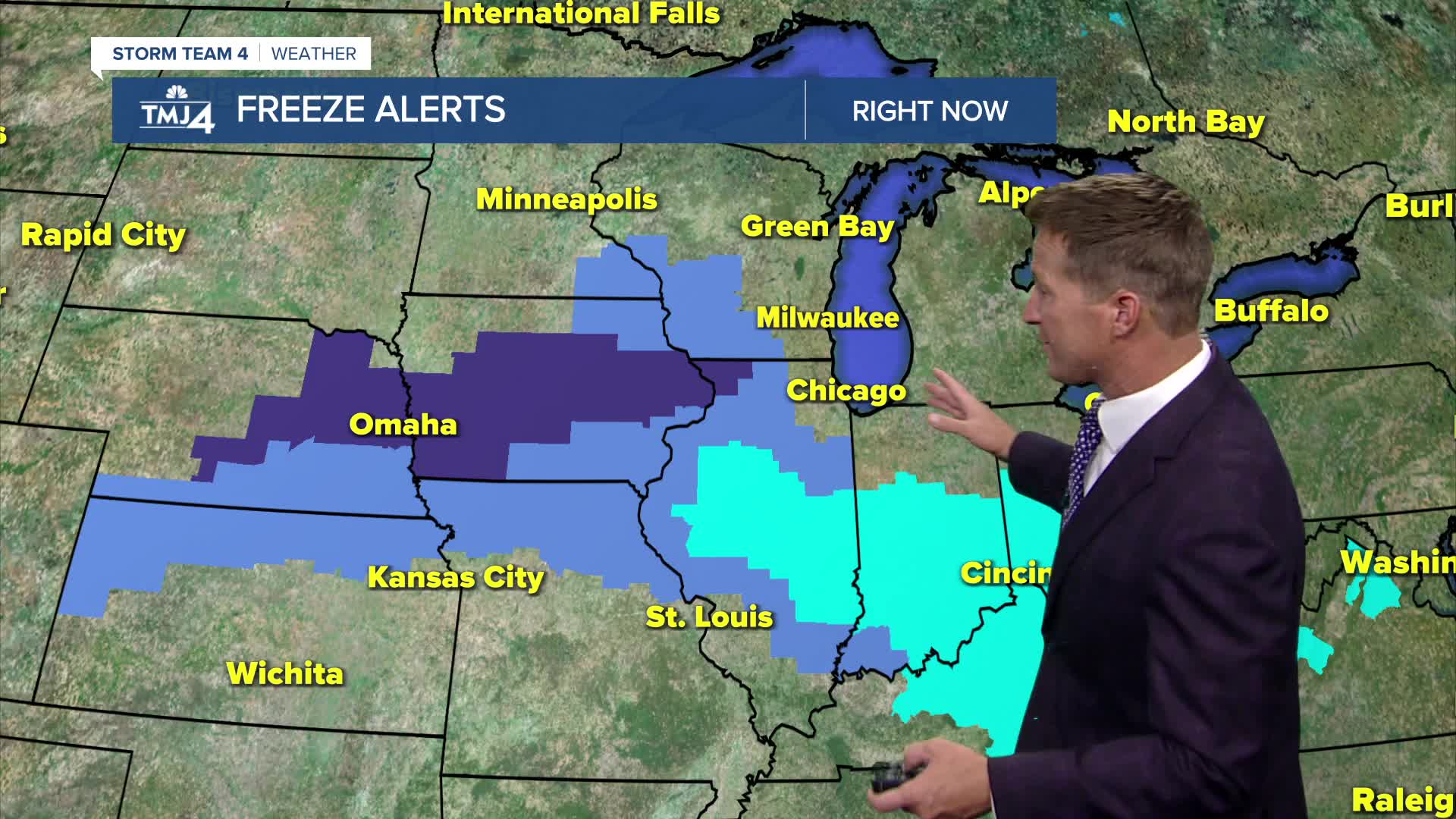


Cool, windy, and gloomy conditions will persist tonight. The clouds prevent us from dipping to near freezing tonight, with frost advisories and freeze warnings posted to our west and south. A few sprinkles or very light showers remain possible tonight.
The clouds should break a bit more tomorrow, and eventually our skies will clear out tomorrow night. This will set up our coolest night of the season so far, with frost possible everywhere and freeze likely inland.
Watch: When sunshine and warmer weather return
Temperatures head back up this weekend, along with a decent amount of sunshine.
TONIGHT: M. Cloudy & Cool. Windy With Sprinkles
Low: 41
Wind: W 10-20 mph
THURSDAY: Partly Cloudy, Breezy, and Cool
High: 50
Wind: NW 10-15 mph
FRIDAY: Mostly Sunny
High: 54
SATURDAY: Partly Cloudy
High: 58
SUNDAY: Partly Cloudy
High: 61
It’s about time to watch on your time. Stream local news and weather 24/7 by searching for “TMJ4” on your device.
Available for download on Roku, Apple TV, Amazon Fire TV, and more.
