

Hot & humid weather is on the way to southeast Wisconsin this week! Get ready for a heat wave!
Overnight lows fell back into the 50s and that'll be the last time for a while.
Sunshine is back this morning, but a complex of showers/storms is moving East towards Wisconsin. Cloud cover spreads over the region this afternoon and there is a chance for a few spotty showers. Lows only fall into the mid/upper 60s tonight. Additional showers/storms may launch farther North of Milwaukee, but hot air aloft may prevent any storms from initiating.
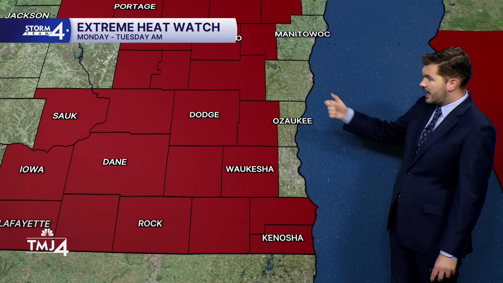
Temperatures will quickly soar into the 80s & 90s Monday afternoon. The National Weather Service has issued an Extreme Heat Watch for much of southern Wisconsin. Those in Milwaukee, Ozaukee & Sheboygan counties may avoid the worst of the heat thanks to the lake. Heat Index values in the watch area could jump as high as 105°.
The heat and humidity persists into Tuesday & Wednesday. Showers/storms will travel near the edge of the upper-level ridge (way to our North). However, as the ridge moves East & sinks South, some of that rain could drift into southern Wisconsin. Rain chances increase towards the end of the week. Any rain would offer some temporary heat relief. The hot weather will likely continue into the holiday weekend.
SUNDAY: Partly Cloudy; Slight Ch. Shower/Storm Late
High: 75 Lake 85 Inland
Wind: SE 5-10 mph
TONIGHT: Partly Cloudy
Low: 69
Wind: SE 5-10 mph
MONDAY: Mostly Sunny, Hot, and Humid
High: 95, Heat Index 102
TUESDAY: Mostly Sunny, Hot, and Humid
High: 95, Heat Index 105
WEDNESDAY: Mostly Sunny, Hot, and Humid
High: 94, Heat index 105
THURSDAY: Mostly Sunny, Hot, Humid; Slight Chance PM Storms
High: 92, Heat Index 100
It’s about time to watch on your time. Stream local news and weather 24/7 by searching for “TMJ4” on your device.
Available for download on Roku, Apple TV, Amazon Fire TV, and more.
