

FLOOD WATCH: A Flood Watch is in effect for Fond du Lac, Sheboygan, Dodge, Jefferson, Kenosha, Milwaukee, Ozaukee, Racine, Walworth, Washington and Waukesha Counties through 10 a.m. Sunday.
We still have a stationary front hanging around our area. This will be the focal point of more, potential shower and thunderstorm development as the night wears on.
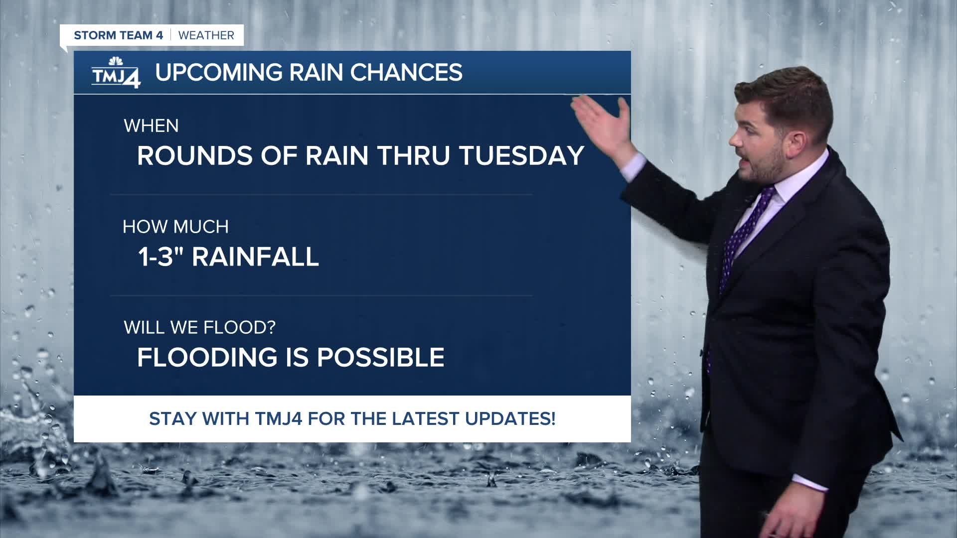
Computer models have been completely unreliable, so it really is a, "Wait, watch and track," situation. With all the humidity, more heavy downpours will be possible if you would end up under one of these storms. The ground is still saturated so any heavy downpour would have a big impact. Because of this, the National Weather Service has a *Flood Watch in effect until Sunday morning.* Lows tonight will be warm and muggy around 70.
It is possible that there could be a lingering shower on Sunday morning, but if there is, it will move out, then most of the daytime Sunday should be okay. It also won't get as warm with highs in the upper 70s.
Watch: Some heavy downpours possible tonight; Flood Watch in effect
Sunday night starts off quietly, but we will start to increase the chance of a shower or storm through the overnight. Lows will be in the mid 60s.
Monday will be warm and muggy again with highs in the mid 80s.
Chances of storms continue on Monday night into Tuesday. Highs Tuesday will be in the low 80s.
Wednesday, we finally get rid of the chance of storms with nice highs in the upper 70s.
TONIGHT: Scattered showers and storms redeveloping. Some could produce locally heavy rainfall.
Low: 70.
Wind: N 5-10 MPH.
SUNDAY: A morning shower still possible, then breaks of sun. Not as warm.
High: 77.
Wind: N 10-15 MPH.
SUN NITE: A chance of a shower or t'storm late.
Low: 67.
MONDAY: Warmer and humid again with a chance of showers and t'storms.
High: 85.
TUES: Partly cloudy with a chance of a shower or t'storm.
High: 82.
WEDS: Partly cloudy and more comfortable.
High: 77
It’s about time to watch on your time. Stream local news and weather 24/7 by searching for “TMJ4” on your device.
Available for download on Roku, Apple TV, Amazon Fire TV, and more.
