
It's very muggy outside, which has led to a few pop-up showers. Most locations should stay dry this evening. High humidity will lead to some fog overnight, especially near Lake Michigan. We'll also keep the chance for a light shower.
Watch: When we could see severe weather:
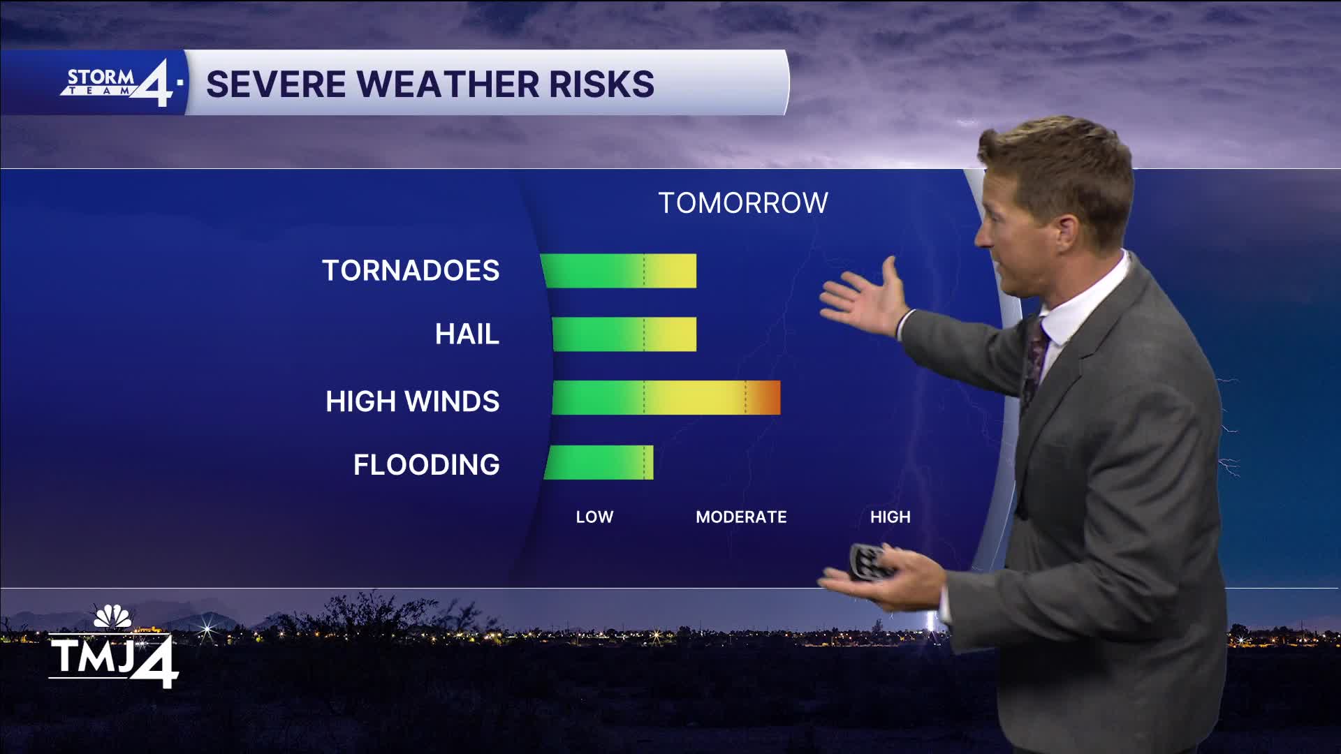
As temperatures heat up, we're going to start focusing our attention on severe storm development. A scattered shower or storm is possible early Wednesday, and then storms are likely in the afternoon and evening.
This may come in two big waves. These storms may be severe, with damaging straight-line wind the primary threat along with brief tornadoes. Yet another round of severe storms is likely late Thursday.
TONIGHT: Humid with Ch. Fog. Slight Ch. Shower
Low: 65
Wind: Calm
WEDNESDAY: Partly Cloudy, Hot and Humid. PM Severe Storms Likely
High: 91
Wind: SW 10-15 mph
THURSDAY: Partly Cloudy, Very Warm and Humid. PM Severe Storms Likely
High: 88
FRIDAY: Partly Cloudy and Breezy
High: 80
SATURDAY: Partly Cloudy. Slight Ch. Showers Late
High: 76
It’s about time to watch on your time. Stream local news and weather 24/7 by searching for “TMJ4” on your device.
Available for download on Roku, Apple TV, Amazon Fire TV, and more.
