

Temperatures are going to drop like a rock tonight, especially once the skies clear out. Clouds and a few flurries will linger up until around 10 p.m. this evening.
Once we lose the blanket in the sky, temperatures will dip into the single digits and then eventually below zero away from Lake Michigan.
Watch: When below-zero wind chills arrive
The wind chill may be as low as -15 by tomorrow morning. Tomorrow morning will be the coldest of the cold snow; however, temperatures will stay well below normal for the rest of the week.
Along with the cold, it will also be quiet. There is only a chance for very light snow Friday night.
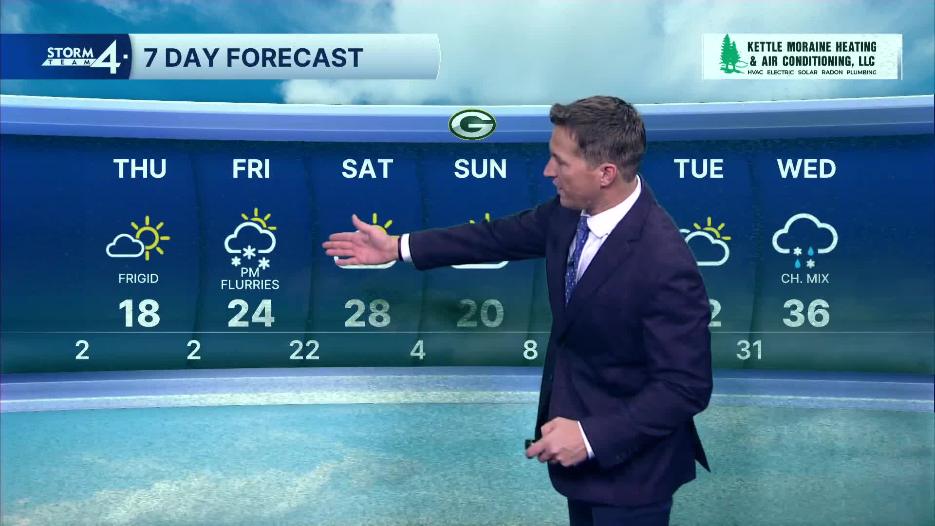
TONIGHT: Flurries Early Then Clearing And Very Cold.
Low: 2 Lake -5 Inland, Wind Chill -5 to -15
Wind: NW 10-15 mph
THURSDAY: Mostly Sunny and Very Cold
High: 18, wind Chill -10 to 0
Wind: NW to SW 10 mph
FRIDAY: Partly Cloudy with Ch. Flurries Late
High: 24
SATURDAY: Partly Cloudy
High: 28
SUNDAY: Partly Cloudy and cold
High: 20
It’s about time to watch on your time. Stream local news and weather 24/7 by searching for “TMJ4” on your device.
Available for download on Roku, Apple TV, Amazon Fire TV, and more.
