

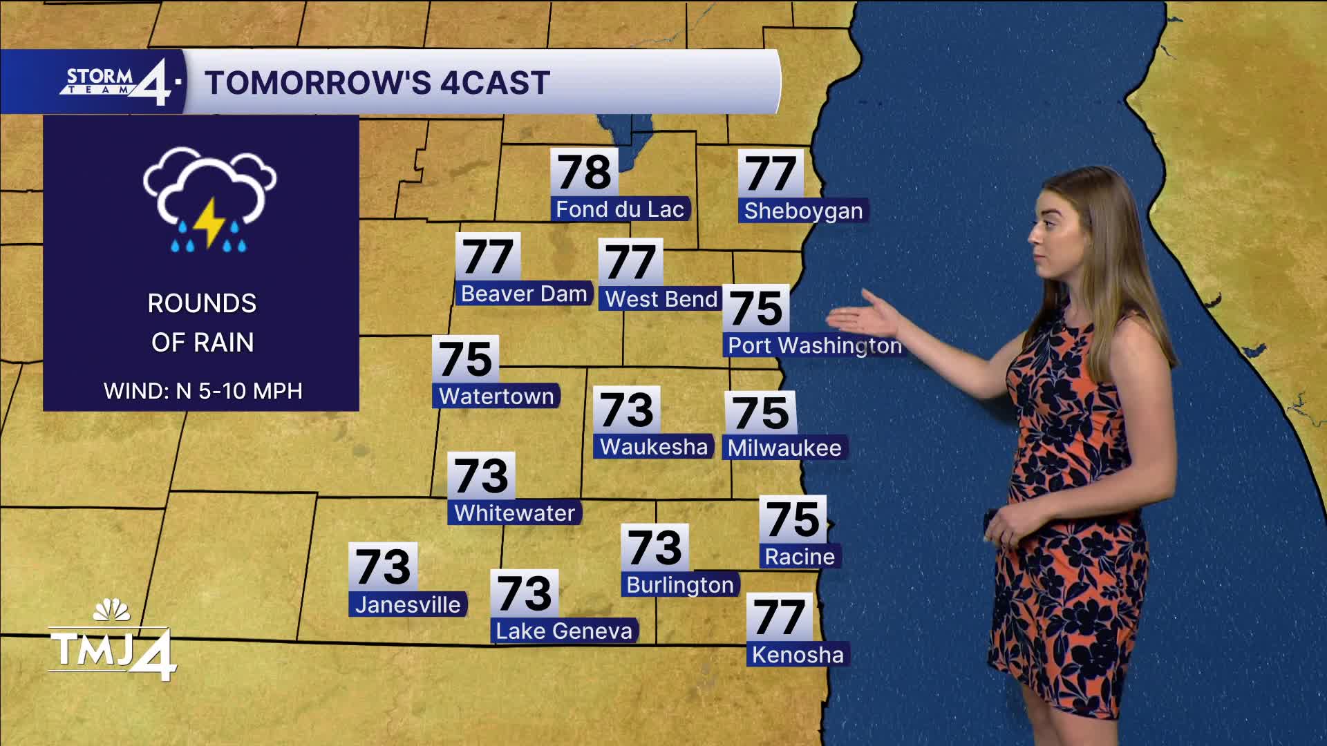


A stationary front will wiggle its way to southeast Wisconsin this evening and overnight. This is going to bring rounds of rain to the area on the order of 1-3 inches (depending on where the front decides to park) on Wednesday.
The main axis is likely south of the state line and into Illinois, where some areas will see up to 4 inches. These rounds of rain taper off in the afternoon as they trek south. Severe weather chances are low at this time, with just downpours and lightning as the primary risks.
Thursday clears out with highs in the upper 70s. Perfect start for the Wisconsin State Fair. Friday features rising temperatures and humidity, with highs in the low 80s. Saturday could squeeze out an isolated thunderstorm in the afternoon with muggy dew points and highs in the mid-80s.
Sunday, we top out in the upper 80s with dew points in the 70s — quite soupy.
Watch your 7-day-forecast here:
HERE'S YOUR LATEST STORM TEAM WEATHER FORECAST FOR MILWAUKEE
AND SOUTHEASTERN WISCONSIN BY METEOROLOGIST LINDSEY SLATER.
TONIGHT: Rain moves in overnight.
Low: 68
Wind: SE 10-15
WEDNESDAY: Rounds of rain that tapers off in the afternoon. 1-3" expected.
High: 75
Wind: NW to E 5-10
THURSDAY: Gradual clearing of clouds.
High: 78
Wind: N to SE 5-10
FRIDAY: Mostly Sunny, muggy
High: 81
Wind: SSE 5-10
SATURDAY: Hot and humid. Sl. Chance of a pop up thunderstorm.
High: 85
Wind: SW 5-10
SUNDAY: Hot and humid.
High: 87
Wind: SW 5-10
MONDAY : Mostly cloudy, chance of a storm.
High: 81
Wind: SW to SE 5-10
It’s about time to watch on your time. Stream local news and weather 24/7 by searching for “TMJ4” on your device.
Available for download on Roku, Apple TV, Amazon Fire TV, and more.
