

Temperatures topped out around 80 in Milwaukee and well into the 80s inland. This stretch of weather is making up for some of the early days we strung together at the end of August and early September.
Watch: When the heat might break
It's going to be another mild night with low temperatures and dew points around 60. Some patchy fog may develop once again.
A stronger east component to the wind tomorrow, Friday, and into the weekend should bring our daytime high temperatures back into the 70s, except for well inland.
High pressure also breaks down, opening up a chance for showers and storms this weekend and into next week.
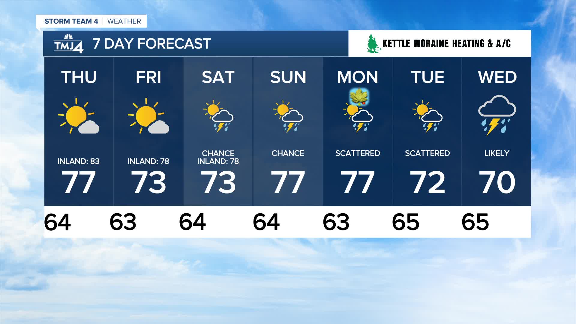
TONIGHT: Mainly Clear. Patchy Fog Possible
Low: 64
Wind: Calm
THURSDAY: Mostly Sunny and Warm. Slight Ch. Shower NW
High: 77 Lake 83 Inland
Wind: NE 5-10 mph
FRIDAY: Mostly Sunny. Slight Ch. Shower NW
High: 73 Lake 78 Inland
SATURDAY: Partly Cloudy with Scattered Showers/Storms
High: 73 Lake 78 Inland
SUNDAY: Partly Cloudy with Scattered Showers/Storms
High: 77
It’s about time to watch on your time. Stream local news and weather 24/7 by searching for “TMJ4” on your device.
Available for download on Roku, Apple TV, Amazon Fire TV, and more.
