

Highs made it to about 60 degrees on Sunday. Temperatures have been below average for seven days so far this month.
Overnight lows dip back into the 30s on Sunday night.
Some patchy frost will also be possible Sunday night.
There is a frost advisory for all of our counties with the exception of Milwaukee, Kenosha, and Racine. This goes into effect at midnight and expires at 8 a.m.
Watch: We may see some rain later this week, but how much?
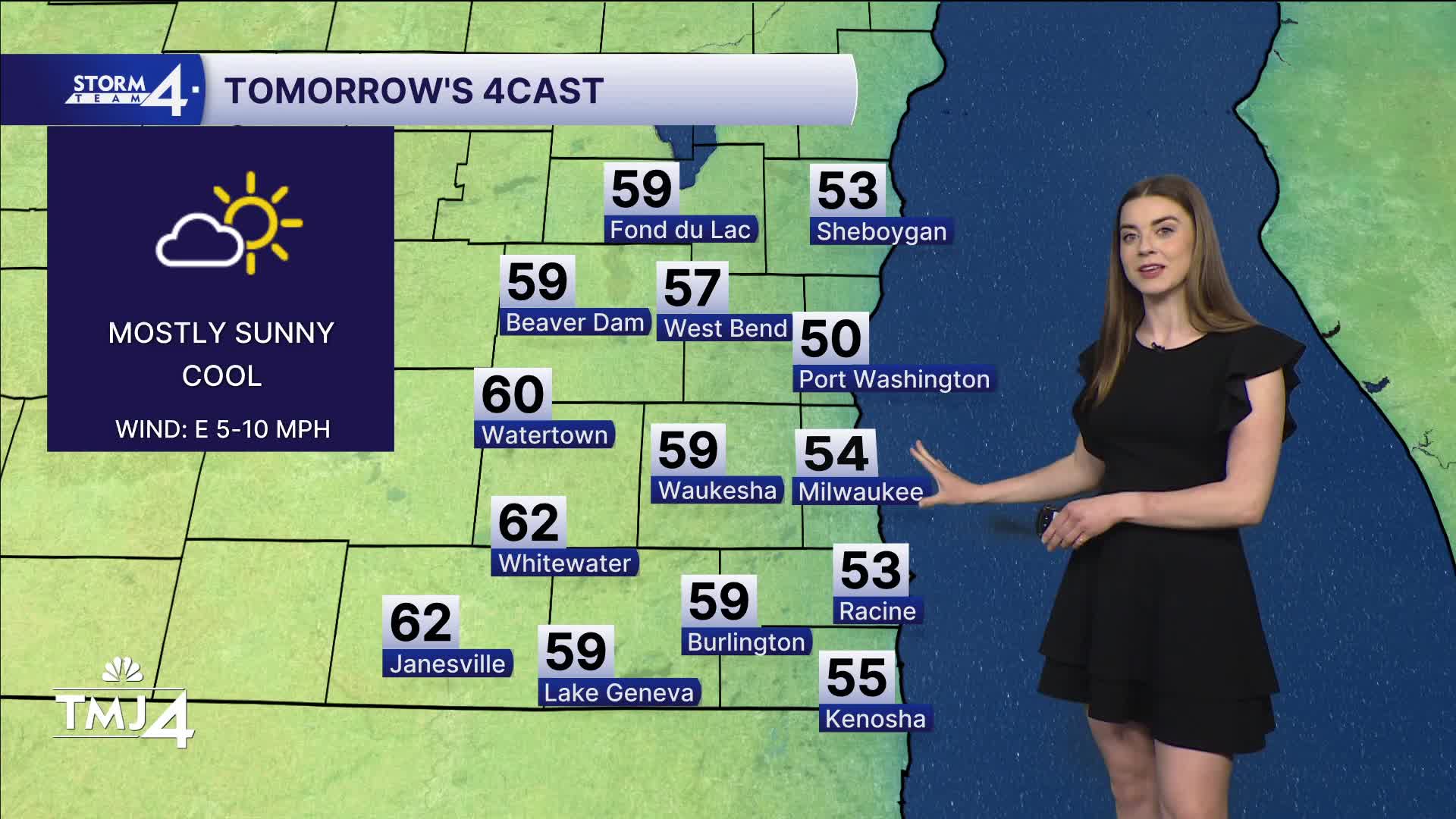
Monday highs are below normal, only reaching the mid 50s.
Rain chances increase for Tuesday. A storm is possible, but severe weather is not expected. Temperatures rebound into the lows 70s. Southerly winds will pick up around 20 mph.
Highs then drop back around 60 for Wednesday and Thursday, once again chilly for May.
Overnight lows are climbing. I hope we can be done talking about frost soon.
This next weekend calls for 70s and isolated storm chances.
SUNDAY NIGHT: Partly cloudy, frost possible
Low: 37
Wind: NE 5-10 mph
MONDAY: Mostly sunny
High: 53 lake, 62 inland
Wind: E 5-15 mph
TUESDAY: Rain likely
High: 72
Wind: S 10-20 mph
WEDNESDAY: Mostly cloudy
High: 60
THURSDAY: Mostly sunny
High: 62
FRIDAY: Partly sunny, chance showers
High: 65
It’s about time to watch on your time. Stream local news and weather 24/7 by searching for “TMJ4” on your device.
Available for download on Roku, Apple TV, Amazon Fire TV, and more.
