

A taste of fall tomorrow into Friday as winds turn to the north behind the front.
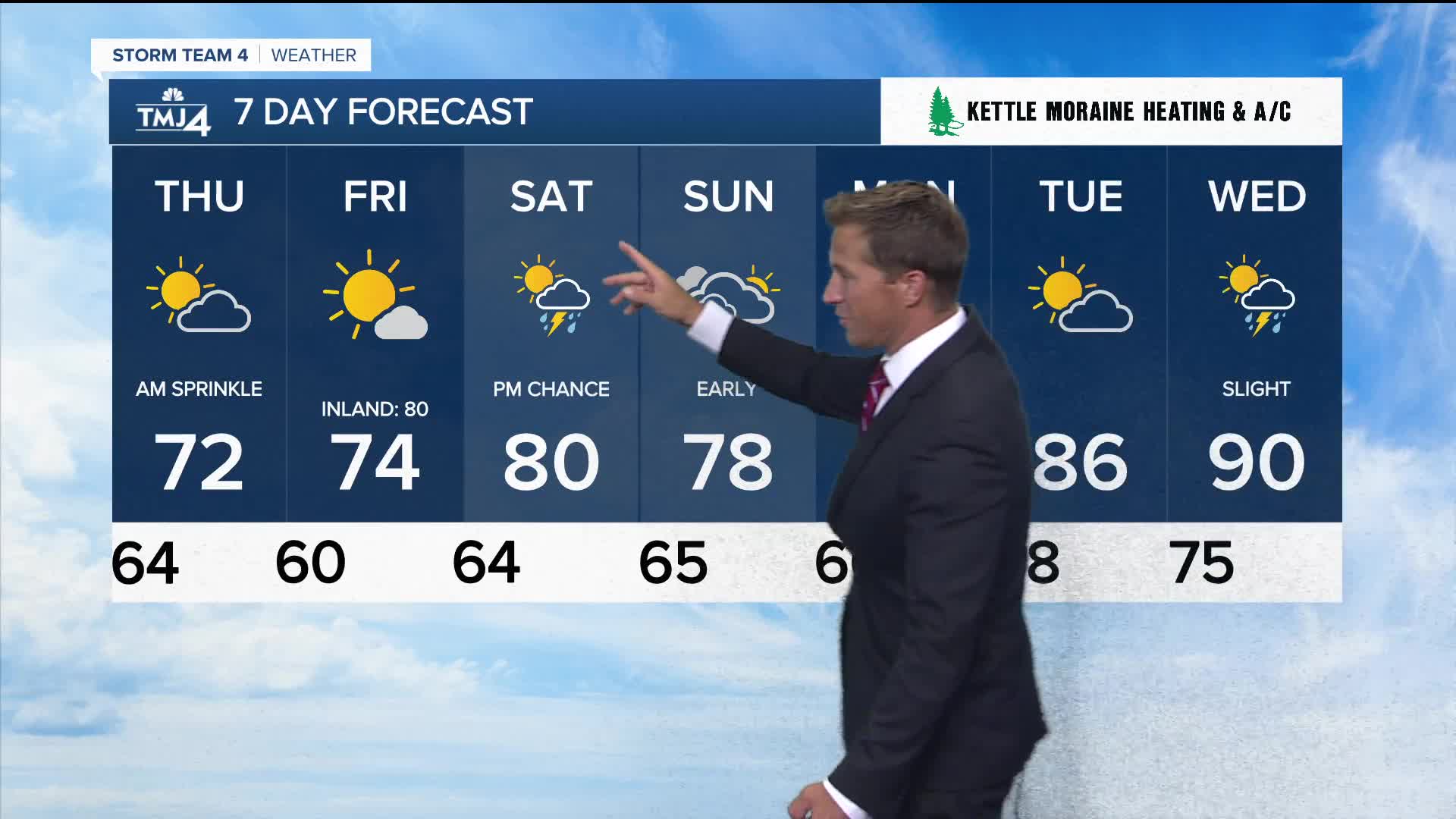
Cooler and drier air will quickly move in tonight into tomorrow. We will start off Thursday a bit cloudy, with even an isolated sprinkle or shower, then clearing skies later in the day. Highs will struggle in the lower 70s, with dew points in the 50s. Beautiful weather on Friday with sunshine and mid-70s — likely the best day of the week.
Watch: When it's going to feel a bit like fall
A taste of fall tomorrow into Friday as winds turn to the north behind the front. Cooler and drier air will quickly move in tonight into tomorrow. We will start off Thursday a bit cloudy, with even an isolated sprinkle or shower, then clearing skies later in the day. Highs will struggle in the lower 70s, with dew points in the 50s. Beautiful weather on Friday with sunshine and mid-70s — likely the best day of the week.
Some rain chances and upper 70s to low 80s return for the weekend. The best chance of rain will be Saturday, with Sunday looking drier.
TONIGHT: Showers & Storms Early, Mostly Cloudy
Low: 63
Wind: NW 5-10 mph
THURSDAY: AM Sprinkle Then Clearing Skies
High: 72
FRIDAY: Mostly Sunny
High: 74
SATURDAY: Partly Cloudy, Sct. Storm Chance
High: 80
SUNDAY: Partly Cloudy, Slight Ch. Rain
High: 77
It’s about time to watch on your time. Stream local news and weather 24/7 by searching for “TMJ4” on your device.
Available for download on Roku, Apple TV, Amazon Fire TV, and more.
