

Southern Wisconsin largely escaped morning severe weather as storms tracked further south. Pop-up storms remain possible this evening as a cold front moves through the area.
Some sunshine has broken through the thick cloud cover today, creating unstable conditions that could trigger isolated storms later this evening. These storms may produce gusty winds and small hail, though severe weather is not expected.
The process of this cold front clearing the region will continue overnight, with clouds possibly lingering tomorrow morning, especially for areas near and south of I-94.
Another storm complex developing over Iowa is expected to move eastward into Illinois, again largely missing Wisconsin. However, communities along the state line should be prepared for possible storms during mid to late morning hours.
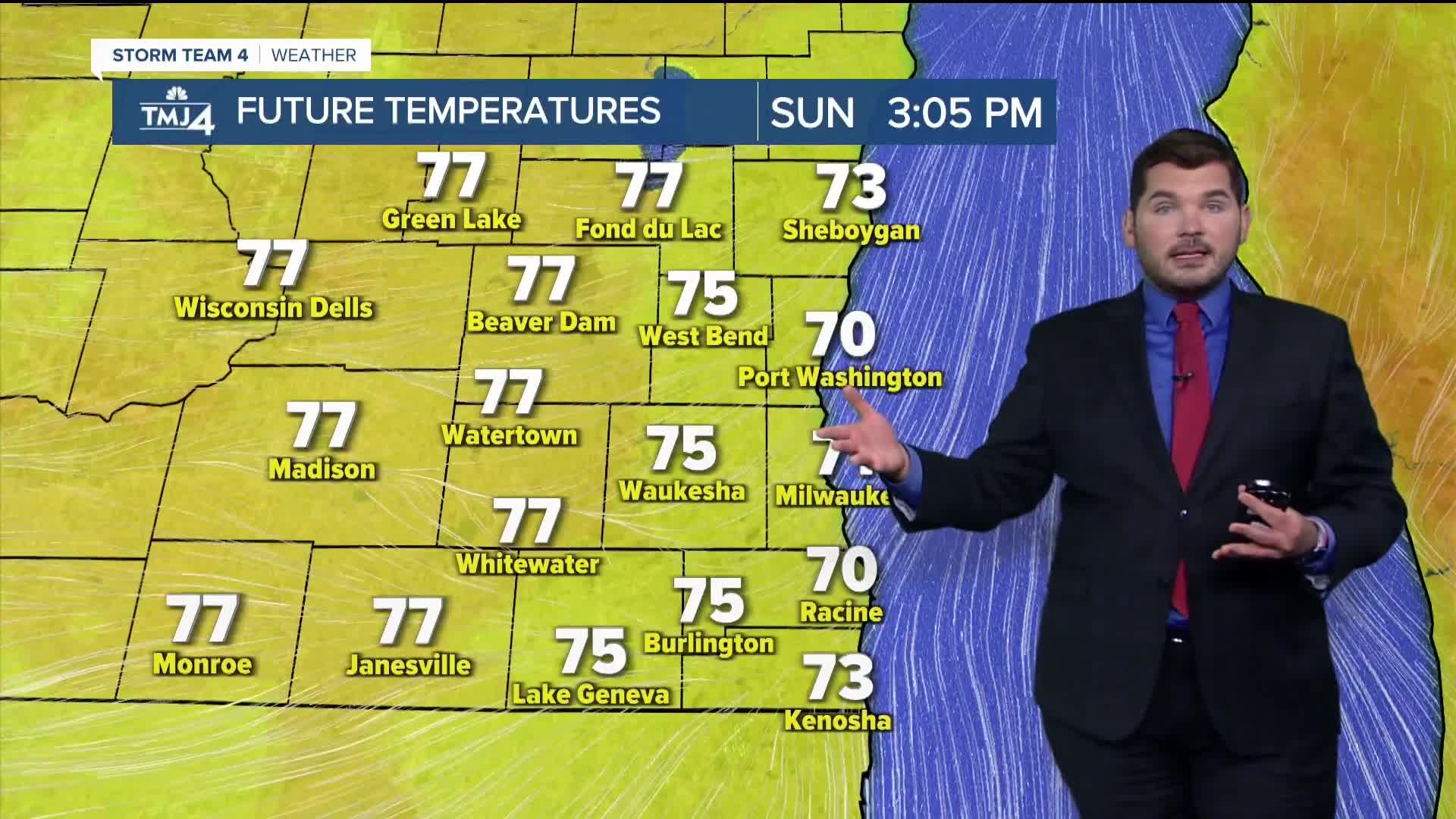
A breezy northeast wind will develop overnight and continue tomorrow, keeping temperatures cooler with highs only reaching the lower and mid 70s near the lakefront.
Lake Michigan will turn choppy near piers and beaches tomorrow. Please use extreme caution if venturing out to the lake.
Looking ahead to next week, high pressure will settle across the northern Great Lakes and southern Canada, bringing calmer conditions initially.
As this high pressure system moves eastward, temperatures will climb back into the 80s and 90s. Southern Wisconsin will be positioned on the edge of a heat dome forming over the southeastern United States.
This "Ring of Fire" pattern typically brings daily rain chances, with rounds of scattered showers and storms possible as precipitation circles the edge of the heat dome. The exact timing and coverage of these potential storms will become clearer in coming days.
This forecast was created by a meteorologist and has been converted to this platform with the assistance of AI. Our editorial team verifies all reporting on all platforms for fairness and accuracy.
SUNDAY: Gradual Clearing; Cooler
High: 75
MONDAY: Mostly Sunny
High: 77
TUESDAY: Mostly Sunny; Slight Chance PM Storm
High: 81
WEDNESDAY: Sunny, Hot & Humid; Slight Chance Showers/Storms
High: 91
THURSDAY: Mostly Sunny, Hot & Humid; Chance Showers/Storms
High: 90
It’s about time to watch on your time. Stream local news and weather 24/7 by searching for “TMJ4” on your device.
Available for download on Roku, Apple TV, Amazon Fire TV, and more.
