



Light to Moderate rain has moved in and will be with us through the night. There may be some pockets of heavier rain, but no severe weather is expected.
Watch: Soaking rain on the way. How long will it last?
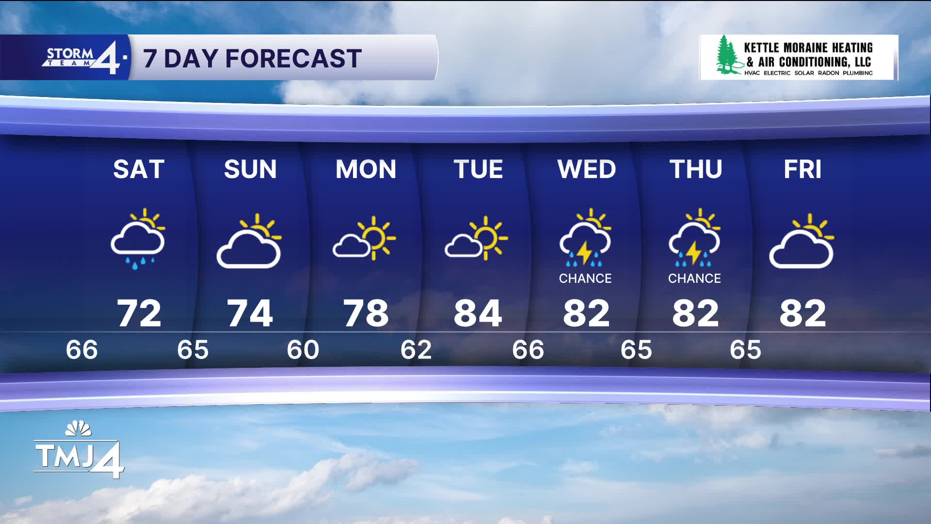
Everyone has a decent shot at 1.0" of rain, but some locally higher amounts are also possible, especially south of Milwaukee. At the very least, expect scattered showers to linger much of the day on Saturday, with the afternoon providing a much better chance of being dry. A strong northeast breeze also ramps up tonight and will drive in cooler air through the weekend. Highs both Saturday and Sunday will be around 70 degrees.
Tonight: Rain Likely and Breezy. Up to 1.0" rain
Low: 66
Wind: SE to NE 15 MPH
SATURDAY: Showers likely and Windy. Up to 0.50" Additional Rain
High: 72
Wind: NE 15-25 mph
SUNDAY: Partly Cloudy and Windy
High: 74
Wind: NE 15-25 mph
MONDAY :Mostly Sunny and Beautiful
High: 78
TUESDAY: Mostly Sunny and Warmer
High: 84
It’s about time to watch on your time. Stream local news and weather 24/7 by searching for “TMJ4” on your device.
Available for download on Roku, Apple TV, Amazon Fire TV, and more.
