WeatherForecastToday's Forecast

Actions

Southeast Wisconsin weather: Showers tonight; Watching for weekend wintry mix

Tracking Weekend Wintry Mix
and last updated

Storm Team 4 is monitoring an active weather pattern over the next 72 hours. A frontal system brings the chance for scattered showers and an uptick in wind speeds tonight.

Then, a clipper system swings through the Midwest and southern Great Lakes on Saturday. This may bring the first chance of wintry weather to the region before arctic chills kick in early next week.

Overnight lows fell into the 30s thanks to a clear sky and lighter winds. Sunshine is back overhead today as highs climb into the mid-50s. An approaching low-pressure system will drag a warm front through southern Wisconsin late tonight. Southerly winds ramp up, gusting as high as 35 mph. Scattered showers are expected with this activity, primarily between 10 p.m. and 2 a.m. Rain chances and wind will gradually diminish into Friday morning’s commute.

Watch: When snow could arrive and if it’ll stick
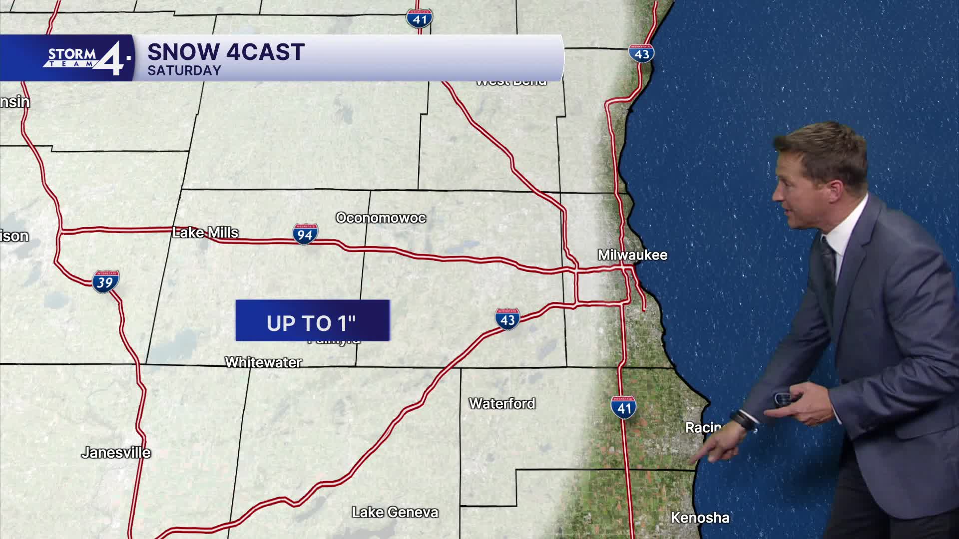
Tracking Weekend Wintry Mix

Highs jump to near 60 before crashing through the weekend. After the early Friday showers, a dry period takes hold for the afternoon. There are some signals for a few additional sprinkles in the late afternoon as a secondary cold front moves by.

The clipper system arrives by Saturday afternoon, prompting an initial chance for scattered showers. Highs top out in the mid-40s. As northwest winds pick up, colder air rushes in and changes rain to snow. Storm Team 4 is closely monitoring the track of this clipper system. It may track through or near southern Wisconsin. The best chance for steady snow will be just north of the low’s center. Any shifts in track will impact snow coverage and amounts.

As of Thursday morning, the 4Cast calls for a rain/snow mix late Saturday and into early Sunday morning. This may leave a slushy accumulation on grassy and elevated surfaces. Those who see more of the steady snow may wind up with some slushy accumulations on roadways for a brief time. Blustery conditions are expected Saturday and into Sunday as the low passes by.

Cold northwest winds continue on Sunday, dropping lows into the 20s and keeping highs in the mid to upper 30s. Some snow flurries are possible on Sunday as the low exits to the east. Again, some accumulation is possible on elevated and grassy surfaces. Widespread impacts are not anticipated, but this is our first chance for wintry weather. Caution is advised.

Temperatures gradually warm back up to seasonable levels by mid-next week.

THURSDAY: Increasing Clouds; Mild

High: 54
Wind: S 5-10 mph

TONIGHT: Chance Showers; Gusty Winds
Low: 46
Wind: SSW 10-15 G 35 mph

FRIDAY: Chance Early Showers; Becoming Mostly Sunny
High: 60
Wind: W 10-15 mph

SATURDAY: Mostly Cloudy & Blustery; PM Rain/Snow Mix Likely; Minor Accumulation Possible
High: 46

SUNDAY: Chance Snow Flurries; Cloudy & Windy
High: 37

MONDAY: Mostly Sunny & Cold
High: 38


It’s about time to watch on your time. Stream local news and weather 24/7 by searching for “TMJ4” on your device.

Available for download on Roku, Apple TV, Amazon Fire TV, and more.