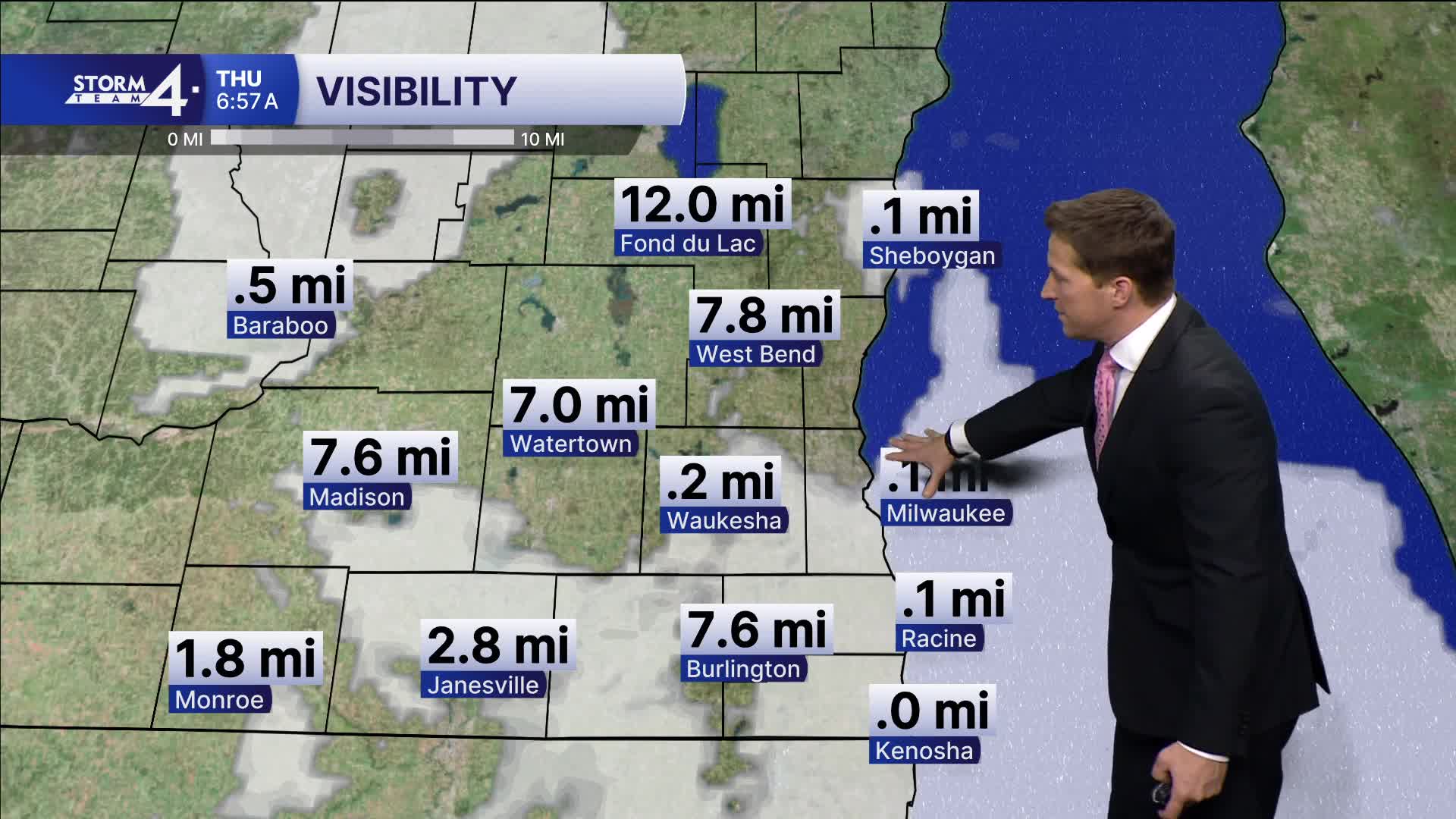


We're keeping an eye on a few light showers to our south that may clip southeastern Wisconsin later tonight. Also, look for fog to return tonight, especially south of Milwaukee. The fog may spread across all of SE Wisconsin by tomorrow morning.
Hit and miss light showers remain possible through tomorrow, with only a few hundredths of an inch possible.
WATCH: When severe weather could set in
Things get pretty interesting Friday. A surge of warm air approaches the upper Midwest by Friday afternoon. A round of rain and storms is likely along this warm front.
Temperatures should then spike Friday evening, followed by more rain and storms arriving overnight. Some severe weather is possible, especially if temperatures rise into the 60s.
We'll wake up to showers and 60 degrees Saturday morning, but the temperature drops into the 40s again by the afternoon.
TONIGHT: Slight Ch. Light Shower and Patchy Fog
Low: 38
Wind: NE 5 mph
THURSDAY: Partly to Mostly Cloudy
High: 42
Wind: NE 5-10 mph
FRIDAY: Mostly Cloudy With Rain/Storms.
High: 56 Lake 64 Inland (Warmth Late)
SATURDAY: Ch. Showers Early And Breezy
High: 60(Falling into 40s by Afternoon)
SUNDAY: Mostly Sunny
High: 60
It’s about time to watch on your time. Stream local news and weather 24/7 by searching for “TMJ4” on your device.
Available for download on Roku, Apple TV, Amazon Fire TV, and more.
