

Storms will pop up this afternoon but should remain widely scattered. Any storm that develops has the environment to grow into a severe storm. Strong winds, large hail, and even an isolated tornado will be possible.
The coverage of the scattered storms will probably increase this evening with most storms ending by midnight. A few showers may linger into Friday morning.
When we finally get a break from the rain chances:
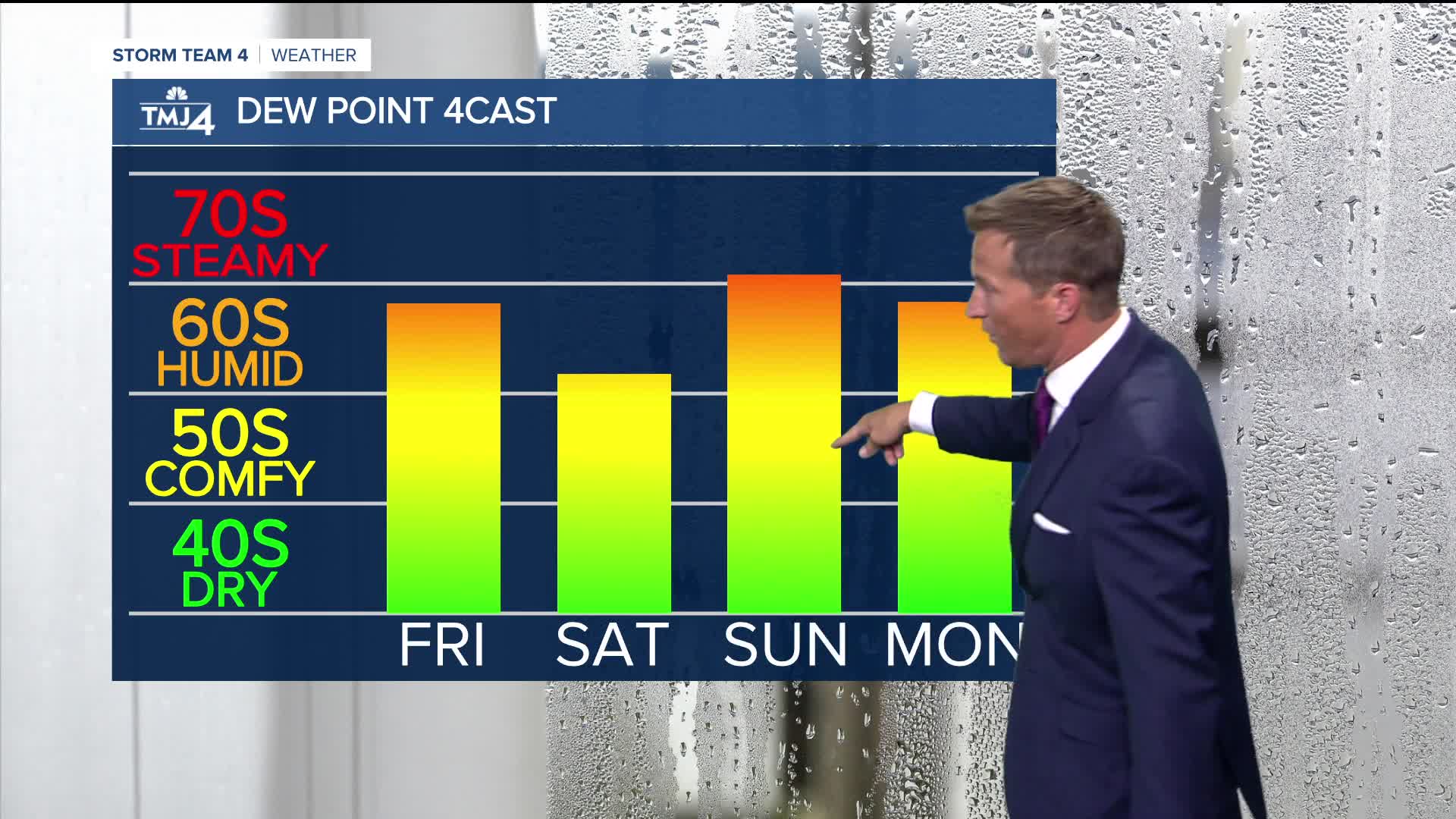
It's looking like a mostly dry weekend ahead with a chance thunderstorms return Sunday night. Saturday should be an awesome summer day with sunshine and highs in the lower 80s. We'll make another run at 90 degrees on Sunday. The increase humidity may make it feel near 100.
TONIGHT: Sct'd T-Storms, Especially Early
Low: 65
Wind: Variable 5 mph
FRIDAY: Stray Morning Shower Possible. Mostly to Partly Cloudy and Breezy
High: 80
SATURDAY: Mostly Sunny
High: 80 Lake 85 Inland
SUNDAY: Partly Cloudy, Hot, and Humid. Ch. T-Storms Late
High: 91
MONDAY: Partly Cloudy
High: 82
It’s about time to watch on your time. Stream local news and weather 24/7 by searching for “TMJ4” on your device.
Available for download on Roku, Apple TV, Amazon Fire TV, and more.
