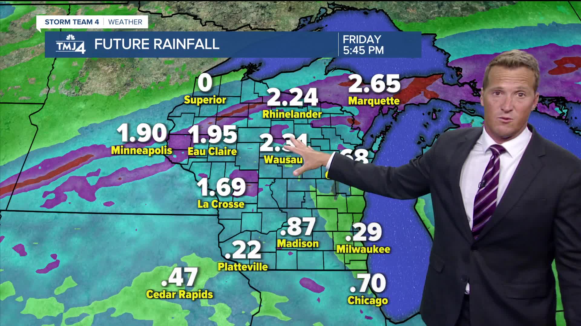


Unstable weather continues tonight with another chance for showers and storms. The severe potential is very low; however, some heavy downpours are likely. We could see a few different waves of these showers and storms with the next round possibly firing up around 7pm.
While our weather remains active, the heaviest rain will track to our northwest over the next couple of days. We'll continue to see scattered showers and storms through Thursday and into early Friday. Nice weather returns Saturday, but heat and storms may return Sunday.
When the sunshine returns:
TONIGHT: Scattered Showers and Storms. Patchy Fog
Low: 63
Wind: Variable 5 mph
THURSDAY: Partly cloudy, Warm, and Humid. Ch Showers/Storms
High: 82
Wind: SW to E 10 mph
FRIDAY: Slight Ch. AM Shower. Mostly Sunny
High: 77 Lake 83 Inland
SATURDAY: Mostly Sunny
High: 80 Lake 84 Inland
SUNDAY: Partly Cloudy, Hot, and Humid. Ch. T-Storms Late
High: 90
It’s about time to watch on your time. Stream local news and weather 24/7 by searching for “TMJ4” on your device.
Available for download on Roku, Apple TV, Amazon Fire TV, and more.
