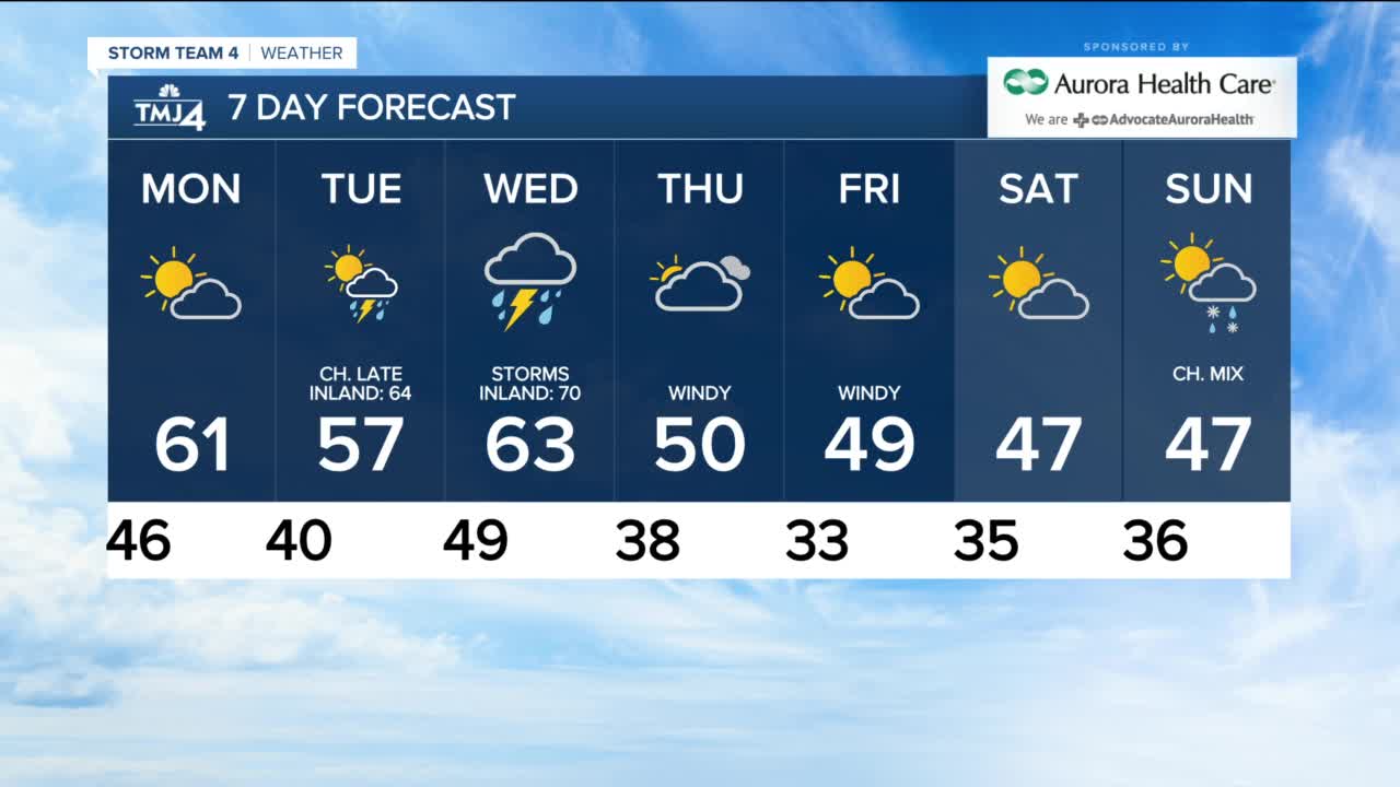


Monday features a mix of sun and clouds and mild temperatures in the upper 50s and low 60s. A few sprinkles are possible, but it will be a largely dry day.
Tuesday highs will warm into the 50s lakeside and 60s inland. A few scattered showers are possible during the day, but a better chance for rain, and even some thunderstorms, are likely by Tuesday night. Some rain and storms may continue overnight and into early Wednesday.
Wednesday brings another chance for rain and storms, with the possibility for strong to severe storms. Stay with us over the next few days for updates on timing and specific storm concerns. Highs will warm into the 60s near the lake, and a few places should make it to 70-inland. A cold front moves through late Wednesday, bringing in cooler air.
Thursday through the weekend highs are back in the 40s to low 50s. Thursday and Friday will be very windy with gusts over 40 mph likely.
MONDAY: Partly to mostly cloudy, a few sprinkles
High: 61
Wind: W 10-15 G 30 mph
TUESDAY: Partly cloudy, showers and chance storms late
High: 57 Lake 64 Inland
WEDNESDAY: T-storms, breezy
High: 63 Lake, 70 Inland
THURSDAY: Mostly Cloudy, Windy
High: 50
FRIDAY: Partly cloudy, Windy
High: 49
