



It's been a fantastic day with the return of full sunshine, temperatures in the 70s, and low humidity. You can expect clear skies tonight with lows in the 60s.
Get ready for warmer temperatures along with higher humidity. This round of warmth will be nothing compared to last week's heatwave, but dew points near 70 will make it feel a bit uncomfortable.
WATCH: Southeast Wisconsin weather: Nice start to the week
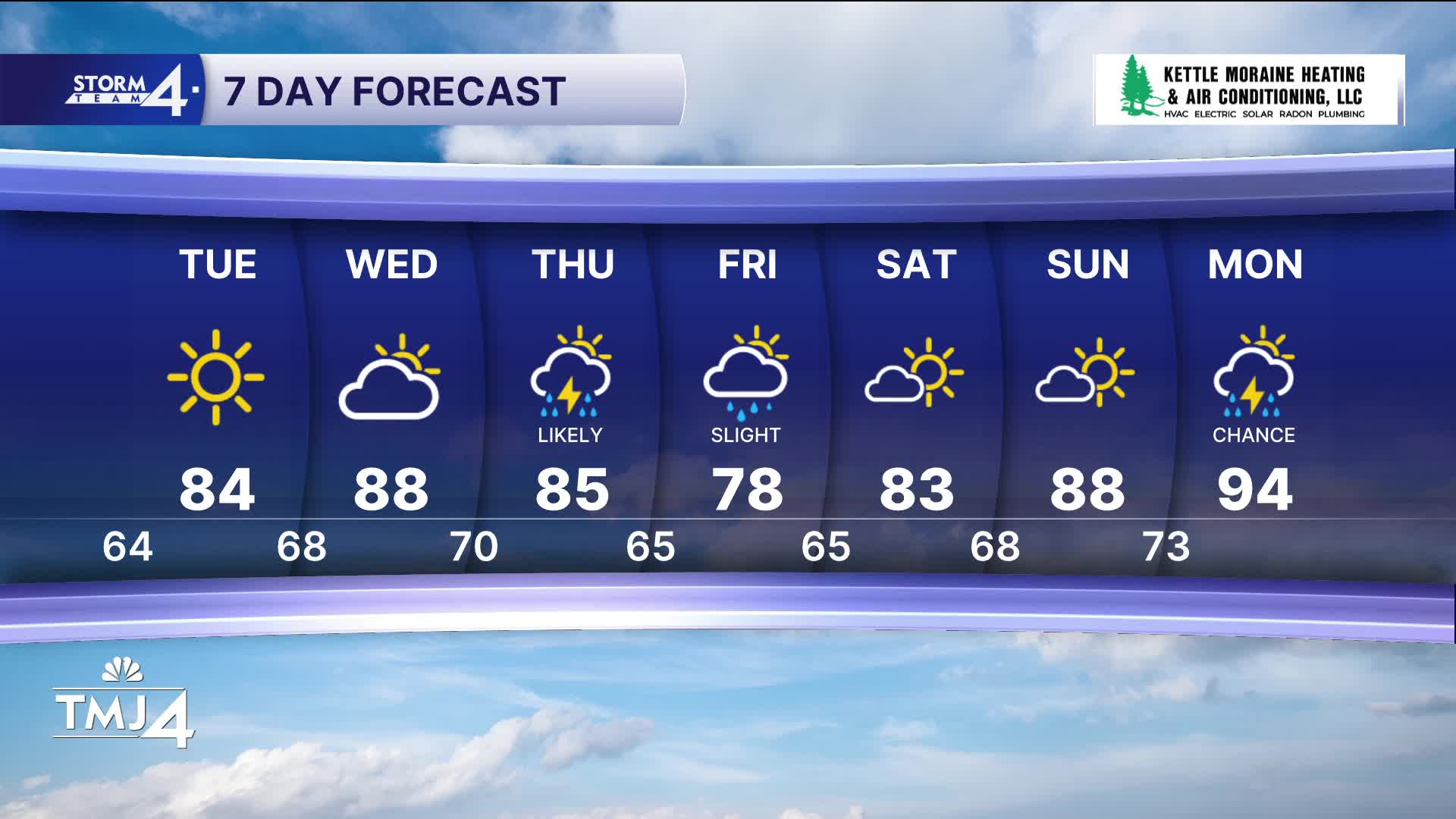
We stay dry until storms return Wednesday night into Thursday. As of right now, the threat for severe weather is pretty low. A slight chance for storms lingers into Friday.
TONIGHT: Clear Skies
Low: 64
Wind: N 5-10 mph
TUESDAY: Sunny and Warm
High: 84
Wind: E 5 mph
WEDNESDAY: Partly Cloudy and Very Warm and Humid
High: 88
THURSDAY: Rain/Storms Likely. Warm and Humid
High: 85
FRIDAY: Parlty Cloudy. Slight Ch. T-Storms
High: 78
It’s about time to watch on your time. Stream local news and weather 24/7 by searching for “TMJ4” on your device.
Available for download on Roku, Apple TV, Amazon Fire TV, and more.
