WeatherForecastToday's Forecast

Actions

Southeast Wisconsin weather: More severe storm chances

Southeast Wisconsin weather: More severe storm chances

Overnight storms latched onto a low-level jet — leading to an intensification rather than weakening. High winds and rotation caused sporadic tree & power line damage. While folks clean up this morning, we're not done with severe weather yet. Another round of storms is expected Tuesday evening with a higher chance of severe weather.

WATCH: Southeast Wisconsin weather: More severe storm chances
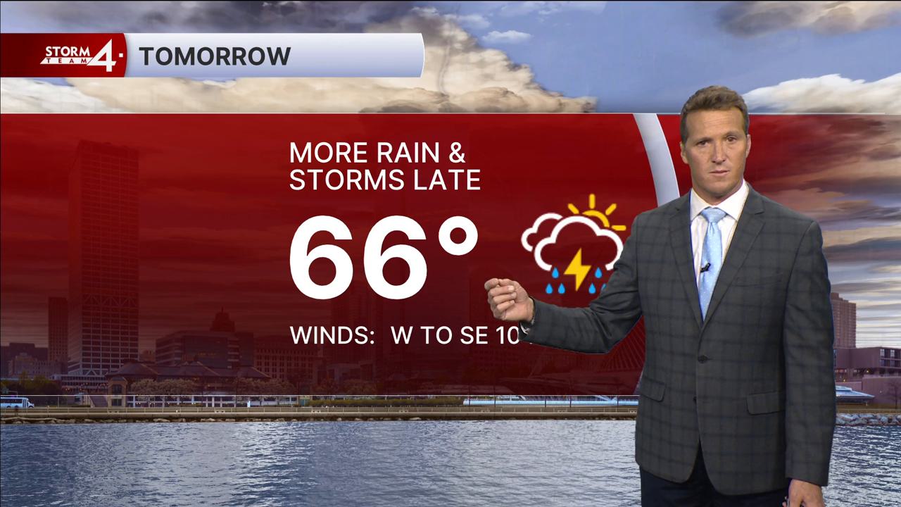
Southeast Wisconsin weather: More severe storm chances

Morning storms will come to a close around daybreak. A solid 0.25" - 0.50" of rainfall has fallen through the Milwaukee area. The frontal boundary which focused yesterday's storm threat has now drifted into SE Wisconsin. Given breezy SW winds and continued warming, an enhanced (Level 3) risk of severe weather has been hoisted for much of southern Wisconsin. Highs jump back into the 70s today under a partly sunny sky. Later this evening, storms are expected to erupt across southern Wisconsin and northern Illinois. All types of severe weather are possible. Storms closest to the frontal boundary may begin to rotate and become tornadic.

Storms will quickly race Eastward from 5-10P. Additional scattered showers are possible Wednesday morning.
Depending on the position of the stalled frontal boundary, additional storms may fire Wednesday evening. A Slight (Level 2) risk of severe weather is in the forecast. Hail and gusty winds are the primary threats with these storms.

In addition to a severe weather threat, flooding is possible in any persistent storms. 1-2" of rainfall has already fallen far North of Milwaukee. Northern counties remain under a Flood Watch until 7A Tuesday. An additional 1-2" of rainfall is possible through Wednesday. Storm Team 4 will be monitoring for additional flood headlines in the days ahead.

Showers begin to wane Thursday morning. After a brief break on Friday, more rain is expected Saturday. Early next week is looking cooler & sunny.

TUESDAY: Partly Cloudy, Warm, and Humid; PM T-Storms Likely
High: 73
Wind: SW 10 mph

TONIGHT: T-Storms Likely; Some Strong
Low: 52
Wind: SE 5 mph

WEDNESDAY: Rain/T-Storms Likely
High: 68
Wind: SW 5-10 mph

THURSDAY: Chance Showers; Mostly Cloudy
High: 63

FRIDAY: Partly Cloudy
High: 63 Lake 74 Inland

SATURDAY: Showers/Storms Likely; Cloudy
High: 63


It’s about time to watch on your time. Stream local news and weather 24/7 by searching for “TMJ4” on your device.

Available for download on Roku, Apple TV, Amazon Fire TV, and more.