

Temperatures have been below average for 10 days, including two days with highs in the single digits. Some lake effect snow showers brought a few inches to the Milwaukee area on Sunday.
Yes, it is still cold, but we don't have any major forecast changes this week.
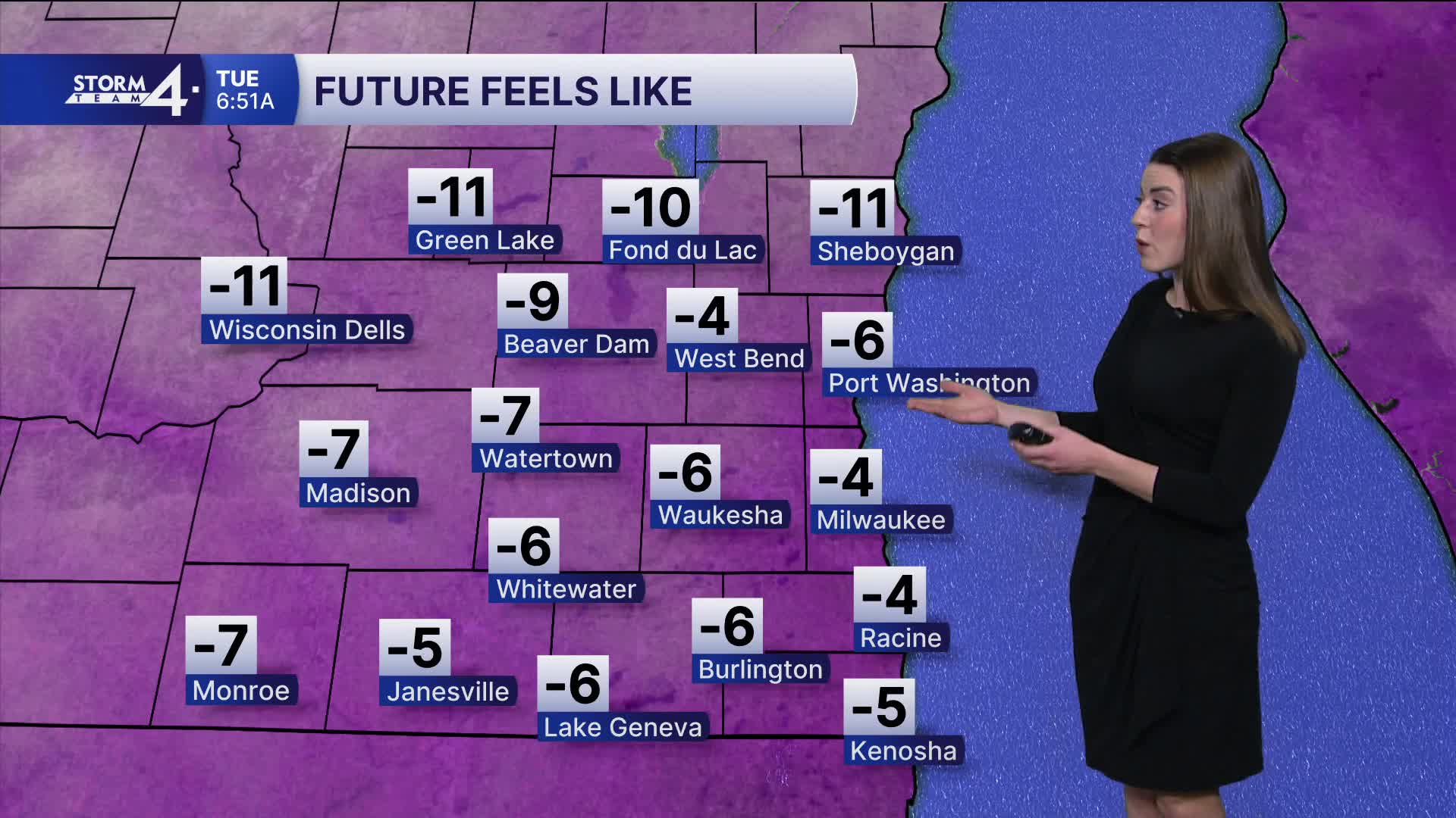
Watch: When wind chills improve
Temperatures stay above 0 degrees tonight. Wind chill values may be down to -10 degrees overnight. This is cold, but not cold enough for an advisory.
Tuesday's high temperatures will surely make it to the double digits. We will see a few more clouds.
Chilly temperatures in the teens will continue to the weekend with a relatively quiet weather pattern. We may hit 20 degrees this weekend - what a treat!
HERE'S YOUR LATEST STORM TEAM WEATHER FORECAST FOR MILWAUKEE
AND SOUTHEASTERN WISCONSIN BY METEOROLOGIST LAUREN LARSEN
TONIGHT: Partly Cloudy, Flurries Possible
Low: 4
Wind: SW 10-15 mph
TUESDAY: Partly Cloudy and Cold
High: 14
Wind: NW 10-20 mph
WEDNESDAY: Mostly Sunny
High: 11
Wind: W 10-15 mph
THURSDAY: Mostly Sunny, Snow Showers Late
High: 12
FRIDAY: Chance Snow, Mostly Cloudy
High 18
SATURDAY: Some Sun
High: 22
It’s about time to watch on your time. Stream local news and weather 24/7 by searching for “TMJ4” on your device.
Available for download on Roku, Apple TV, Amazon Fire TV, and more.
