

We saw sunny skies and highs in the 60s on Sunday.
Low dew points, gusty winds, and warm temperatures have brought very high fire danger conditions to Southeast Wisconsin.
Mostly clear skies will last overnight Sunday, and southerly winds keep our temperatures in the mid 40s overnight.
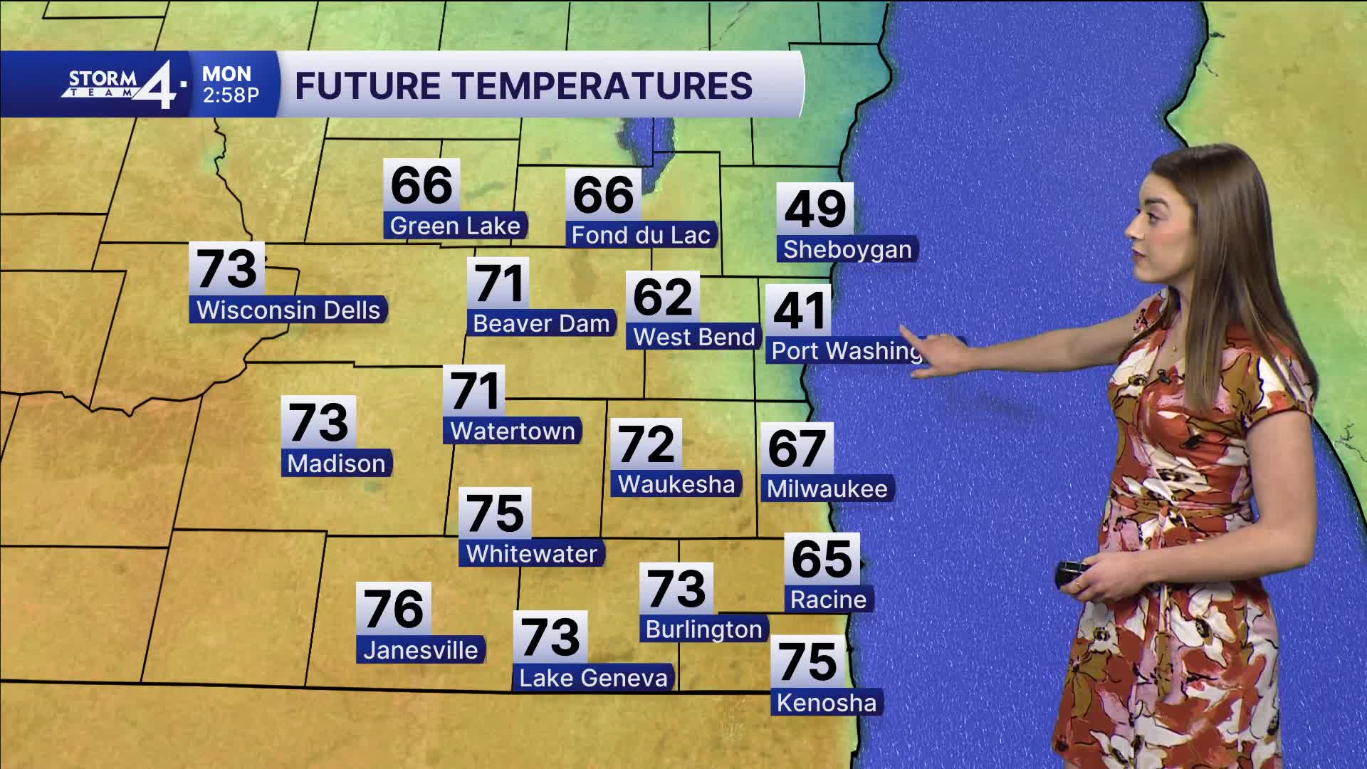
Monday will be mainly dry. Partly cloudy skies and high temperatures in the upper 60s and 70s away from the lake.
Winds are from the SW for most of the day. Once they switch to an easterly direction, temperatures near the lake will drop.
Watch: When we can expect storm chances in Southeast Wisconsin.
Our first chance for a storm this week is Monday night.
More storms are possible on Tuesday; some may be severe. Highs will be in the upper 60s.
Temperatures plummet later this week. We start April below average, in the low 40s.
Cloudy skies and storm chances continue into the weekend. We may even see some mixed precipitation on Thursday.
Stay tuned to Storm Team 4 on air and online for the latest weather updates.
SUNDAY NIGHT: Mostly clear
Low: 45
Wind: SW 10-15 mph
MONDAY: Partly cloudy and warm, storms late
High: 68 lakeside, 74 inland
Wind: SW to E 5-15 mph
TUESDAY: Warm, storms likely
High: 67
Wind: SW 10-15 mph
WEDNESDAY: Mostly cloudy, cool
High: 41
THURSDAY: Mostly cloudy, chance mix
High: 40
FRIDAY: Mostly cloudy
High: 44
It’s about time to watch on your time. Stream local news and weather 24/7 by searching for “TMJ4” on your device.
Available for download on Roku, Apple TV, Amazon Fire TV, and more.
