

Temperatures soared into the 90s today and the high humidity made it feel close to 100 at times. Similar heat is on the way tomorrow before storms roll in tomorrow evening.
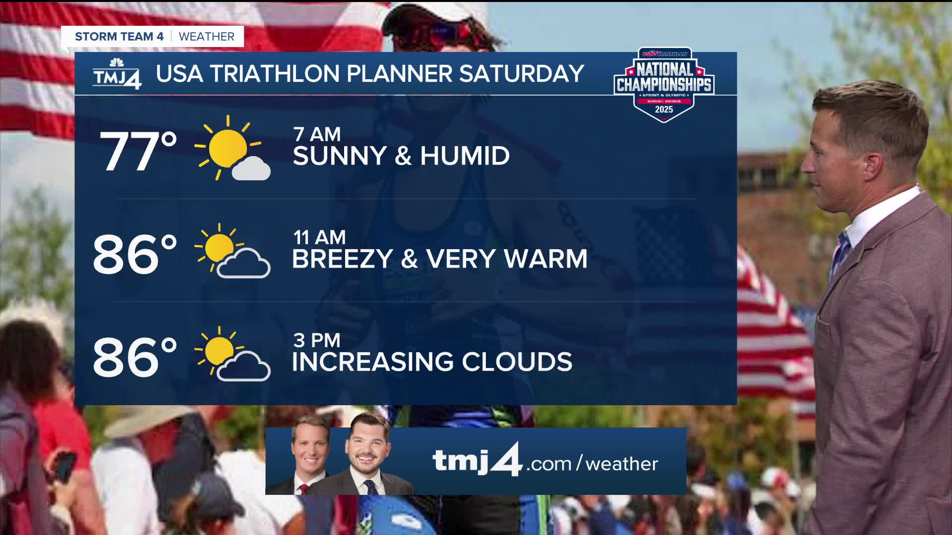
Storms will initially fire up to our northwest early in the day on Saturday. There is a small chance a couple storms clip our northern counties early in the afternoon. The bulk of the storms are likely to move in after 5 p.m. Some of these storms might be severe and some heavy rain is possible northwest of Milwaukee. Most of Southeast Wisconsin is in line to pick up at least an inch of rain, but as much as 3 inches is possible northwest of Milwaukee.
Watch: Summer heat brings the chance for storms this weekend
More rain and storms are possible Sunday and our weather stays active to start our next work week.
As the front moves away on Tuesday, rain chances will begin falling. Highs remain in the lower to mid-80s next week.
TONIGHT: Partly Cloudy and Muggy
Low: 72
Wind: S 10-15 mph
SATURDAY: Breezy, Hot, and Humid With T-Storms Likely Late
High: 93, Heat Index Near 100
Wind: S 10-15 mph
SUNDAY: Partly Cloudy and Muggy with Chance Rain/Storms
High: 85
MONDAY: Partly Cloudy and Humid with Showers Likely
High: 83
TUESDAY: Partly Cloudy, Warm and Humid, Ch. Showers and Storms
High: 85
It’s about time to watch on your time. Stream local news and weather 24/7 by searching for “TMJ4” on your device.
Available for download on Roku, Apple TV, Amazon Fire TV, and more.
