


Brendan Johnson is in Port Washington at Tulip Cafe—out of the rain and beating the heat with great coffee and some famous Hollander chocolate.
The dome of hot air continues to break down and shift southward in the days ahead. We turn from a concern over heat to repeated rounds of downpours and storms.
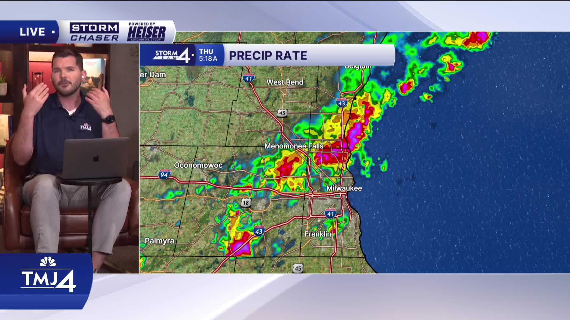
Overnight showers and storms have largely remained sub-severe. Remnant storms may continue to pass over areas North of Milwaukee this morning. The main hazard will be heavy downpours along with some embedded lightning/thunder.
WATCH: Who could see more rain later this afternoon
If lingering showers/storms clear out quickly enough, we'll quickly see highs zoom back into the 90s. Heat index values jump back close to 100-degrees. An Extreme Heat Warning continues until 10P tonight. A remnant boundary left over from this morning's activity will be the focus point for scattered showers/storms this evening. A Slight (Level 2) risk of severe weather is in place over much of Wisconsin.
Once again, showers and storms fizzle out overnight and leads to more heat & humidity on Friday. Another round of showers/storms is expected late Friday and again into Saturday. If you have outdoor plans for the 4th of July weekend, please stay tuned to the forecast!
THURSDAY: Early AM Showers/Storms, Hot and Humid, Ch. Evening T-storms
High: 92, Heat Index 100
Wind: SW 10-15 mph
TONIGHT: Chance Storms; Mostly Cloudy
Low: 73
Wind: SW 5-10 mph
FRIDAY: Partly Cloudy with PM Showers and Storms Likely. Hot and Humid
High: 88, Heat Index 95
SATURDAY: Partly Cloudy with Ch. Showers/Storms
High: 81, Turning Cooler Late
SUNDAY: Slight Chance Rain; Partly Cloudy
High: 81
MONDAY: Mostly Sunny
High: 77
It’s about time to watch on your time. Stream local news and weather 24/7 by searching for “TMJ4” on your device.
Available for download on Roku, Apple TV, Amazon Fire TV, and more.
