

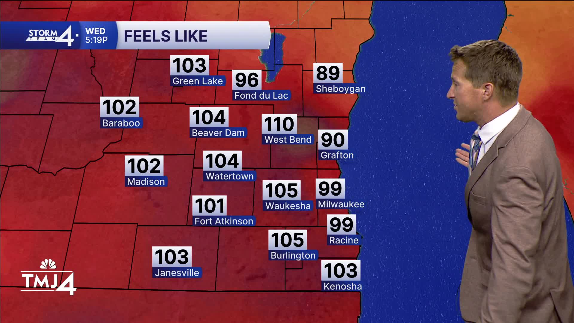


Considering the rise in humidity, it ended up being the most uncomfortable day of the week. Temperatures in the 90s combined with dew points in the 70s created heat index values as high as 108!
WATCH: See how hot it could get before we get some relief
A slow-moving frontal boundary is sagging down from the north. This front will have two big impacts on our weather. As the wind shifts northeast, we can expect a little relief from the heat by tomorrow.
This front also ushers in wildfire smoke. Air quality levels are expected to drop big time tonight and into tomorrow morning.
Our air quality is expected to remain unhealthy right into the weekend.
Also, heads up for small storm chances starting tomorrow.
***A HEAT ADVISORY IS IN EFFECT FOR ALL OF SOUTHEAST WISCONSIN THRU 8P WEDNESDAY***
***AN AIR QUALITY ADVISORY HAS BEEN ISSUED FOR ALL OF WISCONSIN THRU 12P THURSDAY***
TONIGHT: Smokey & Muggy
Low: 72
Wind: NE 5 mph
THURSDAY: Partly Cloudy with Slight Ch. T-Storms, Smokey, Not as Hot
High: 83 Lake 90 Inland
Wind: E 5 mph
FRIDAY: Partly Cloudy, Hot, and Humid. Slight Ch. T-Storms
High: 90
SATURDAY: Partly Cloudy, Hot, and Humid. Slight Ch. T-Storms
High: 91
SUNDAY: Mostly Sunny
High: 80 Lake 86 Inland
It’s about time to watch on your time. Stream local news and weather 24/7 by searching for “TMJ4” on your device.
Available for download on Roku, Apple TV, Amazon Fire TV, and more.
