
Today, highs close to 90 degrees. Sunny skies with increasing clouds and a SW wind 15-20 mph. We are DRY. Drought conditions officially in SE WI (except Sheb and FDL). We are in D2 Moderate drought.
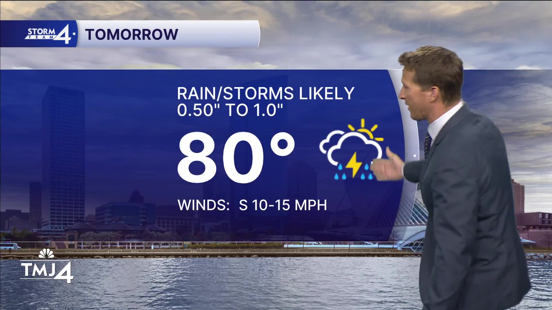
Rain on the way overnight. Likely well after midnight - 2 am time frame. This will likely linger into the Friday AM rush. Then, if we can clear, more pop-up storms in the afternoon could be strong with wind and hail, but not a big overall severe weather threat. Highs in the low to mid-80s with MUCH higher humidity. Air you can wear.
Watch the full 7-Day forecast here:
A bigger batch of rain cycles through overnight, lingering into Saturday.
Overall 0.5-1" total accumulation, with locally higher amounts in some areas under those downpours. Saturday high in the mid 80s. Still a bit soupy.
Cooler Sunday with more sunshine in the mid 70s. More heat and humidity return next week.
TONIGHT: Increasing showers overnight
Low: 65
Wind: SW 15-20
FRIDAY: Batches of showers and storms.
High: 83
Low: 63
Wind: SW 10-15
SATURDAY: Early showers, then clearing. Muggy.
High: 85
Low: 58
Wind: W to E 5-10
SUNDAY: Nice day and less humid
High: 74
Low: 57
Wind: NE 10-15
MONDAY: Chance of showers. Humidity returns.
High: 81
Low: 64
Wind: SE 10
It’s about time to watch on your time. Stream local news and weather 24/7 by searching for “TMJ4” on your device.
Available for download on Roku, Apple TV, Amazon Fire TV, and more.
