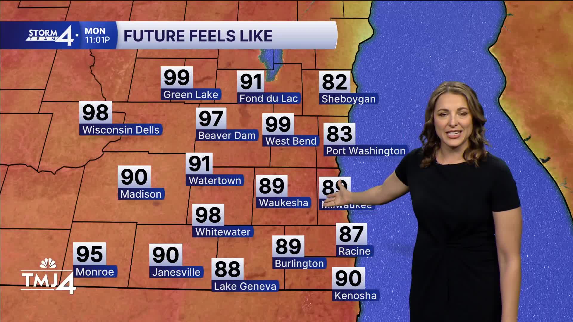


Big story is the heat! An extreme heat warning is in effect starting at noon and continues until 7 p.m. Tuesday. That’s a decent-sized warning, meaning the overnight lows provide no real relief to those without air conditioning. Heat index values will be near or over 105 degrees.
WATCH: How high the heat index will feel in your Storm Team 4Cast
It will be sunny today through much of the week with minimal storm chances to provide a break until late week.
Tuesday: Mid- and upper 90s. Sunny. Wednesday is the same. We will likely see another heat advisory or extreme heat warning issued following Tuesday evening.
Beaches: Moderate to high swim risk with 3- to 5-foot waves in Milwaukee and 5- to 7-foot waves in Sheboygan. Swimming is not recommended in the high-risk zones — insult to injury, really.
TODAY: Extreme Heat warning starts at noon. Mostly sunny. Breezy. Very humid.
High: 94
Wind: SW 15-25
TONIGHT: Very muggy. Warm.
Low: 76
Wind: SW 15
TUESDAY: Extreme heat warning in effect until 7pm. Heat index over 100 degrees. Hot and very humid.
High: 95
Wind: SW 15
WEDNESDAY: Chance storms north and central WI. Chance for us late in the day (but mainly north counties) Sunny with high heat and humidity again.
High: 96
THURSDAY: Mostly sunny with sl. Chance storms.
High: 95
FRIDAY: Chance of storms again. Especially north. Hot and humid.
High: 91
It’s about time to watch on your time. Stream local news and weather 24/7 by searching for “TMJ4” on your device.
Available for download on Roku, Apple TV, Amazon Fire TV, and more.
