

A backdoor cold front will drop in from the NE throughout today. There is some uncertainty about the timing of this front, but afternoon temperatures will range from the 60s and 70s near the lake to the mid-80s farther inland.
As the cold front moves farther West, there is a slight chance for an isolated shower/storm, mainly north of Milwaukee, with a very small chance of minor severe weather. Overnight lows will be cooler as they fall into the 50s.
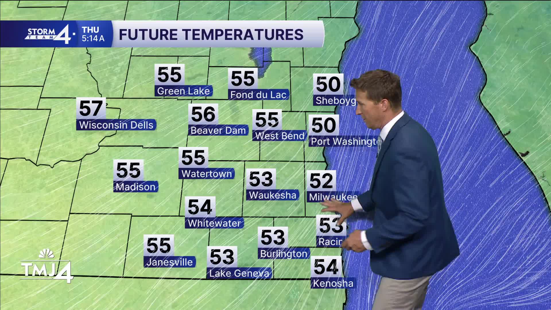
Cooler conditions are expected Thursday as highs only rebound into the mid-60s at the lake front and lower 70s inland. An extended period of dry weather takes us through the weekend and early next week. Highs will remain near and above normal.
Watch the full 7-Day forecast below:
WEDNESDAY: Mostly Sunny; Storm Chance Late North
High: 72 Lake Inland: 85
Wind: NE 5-10 mph
TONIGHT: Mainly Clear. Storm Chance North
Low: 50
Wind: NE 10 mph
THURSDAY: Mostly Sunny
High: 64 Lake 72 Inland
FRIDAY: Sunny
High: 76 Lake 84 Inland
SATURDAY: Sunny
High: 70 Lake 77 Inland
SUNDAY: Mostly Sunny
High: 73 Lake 77 Inland
It’s about time to watch on your time. Stream local news and weather 24/7 by searching for “TMJ4” on your device.
Available for download on Roku, Apple TV, Amazon Fire TV, and more.
