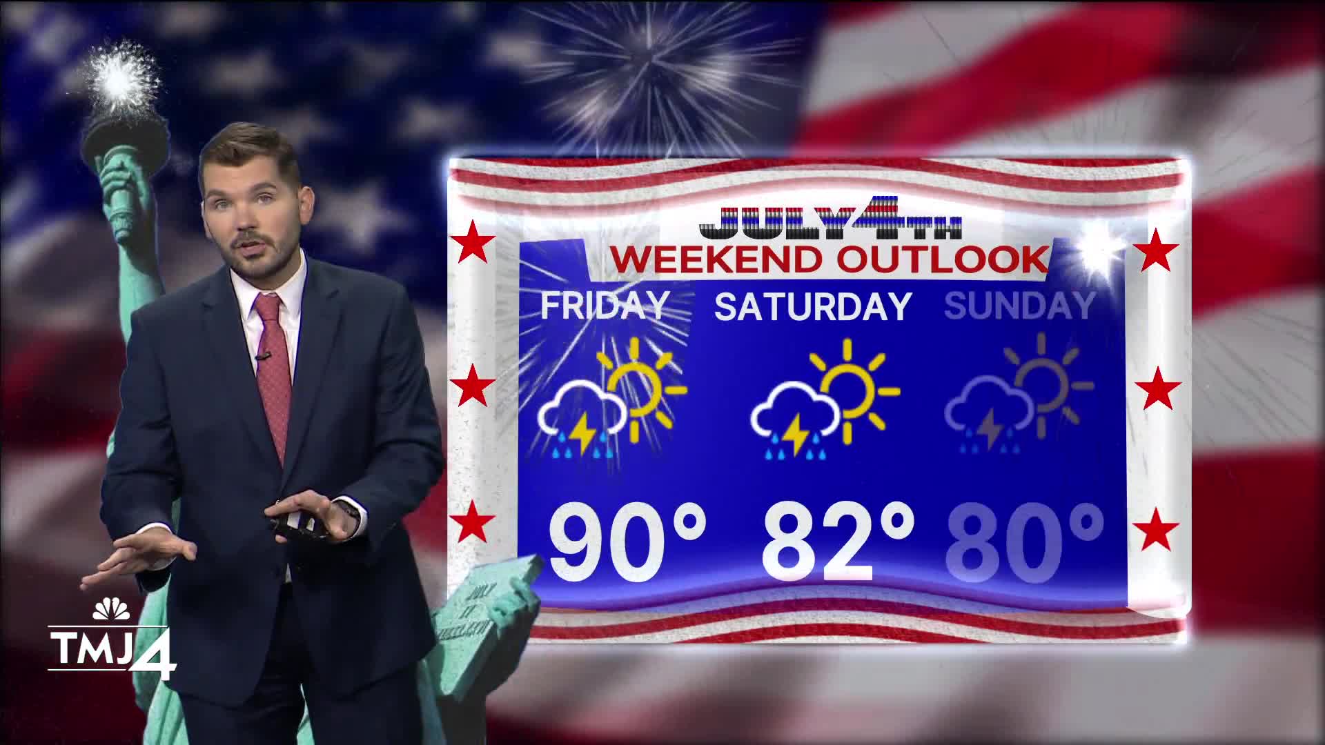


Overnight showers and storms have stayed largely south in Illinois. Cloud cover is rolling in from the West and there is a conditional chance for showers/storms later this afternoon & evening. If there is enough sunshine, some strong to severe storms would be more likely. The strongest storms could contain gusty winds and hail. There is a better chance of stronger storms to the South of I-94 towards the State Line.
Some showers/storms may linger into the overnight hours. Another round of showers/storms is possible first thing Saturday morning. Additional waves of rain/storms are possible Saturday evening. If you have outdoor holiday plans, please stay weather aware & download the TMJ4 News app. There will be dry time during the 4th of July, but rounds of storms may impact plans — including firework displays.
A few more showers are possible on Sunday before sunshine returns early next week.
WATCH: What will the holiday weekend weather look like?
HERE'S YOUR LATEST STORM TEAM WEATHER FORECAST FOR MILWAUKEE
AND SOUTHEASTERN WISCONSIN BY METEOROLOGIST BRENDAN JOHNSON
FRIDAY: Chance PM Showers/Storms; Some could be Strong
High: 90 Heat Index: 96
Wind: S 5-10 mph
TONIGHT: Chance Showers/Storms; Mostly Cloudy
Low: 70
Wind: SW 5 mph
SATURDAY: Rounds of storms possible; Some dry time.
High: 82
Wind: NE 5-10 mph
SUNDAY: Chance Showers/Storms
High: 80
MONDAY: Mostly Sunny
High: 78
TUESDAY: Mostly Sunny
High: 81
It’s about time to watch on your time. Stream local news and weather 24/7 by searching for “TMJ4” on your device.
Available for download on Roku, Apple TV, Amazon Fire TV, and more.
