



We are sizzling. Highs near 98, and we are already at 95 at 130PM.
Luckily the dews at lower than the last time - so the heat index isn't much higher than the temperature.
Heat advisory in effect (started at noon) and goes until Wednesday 8 p.m.
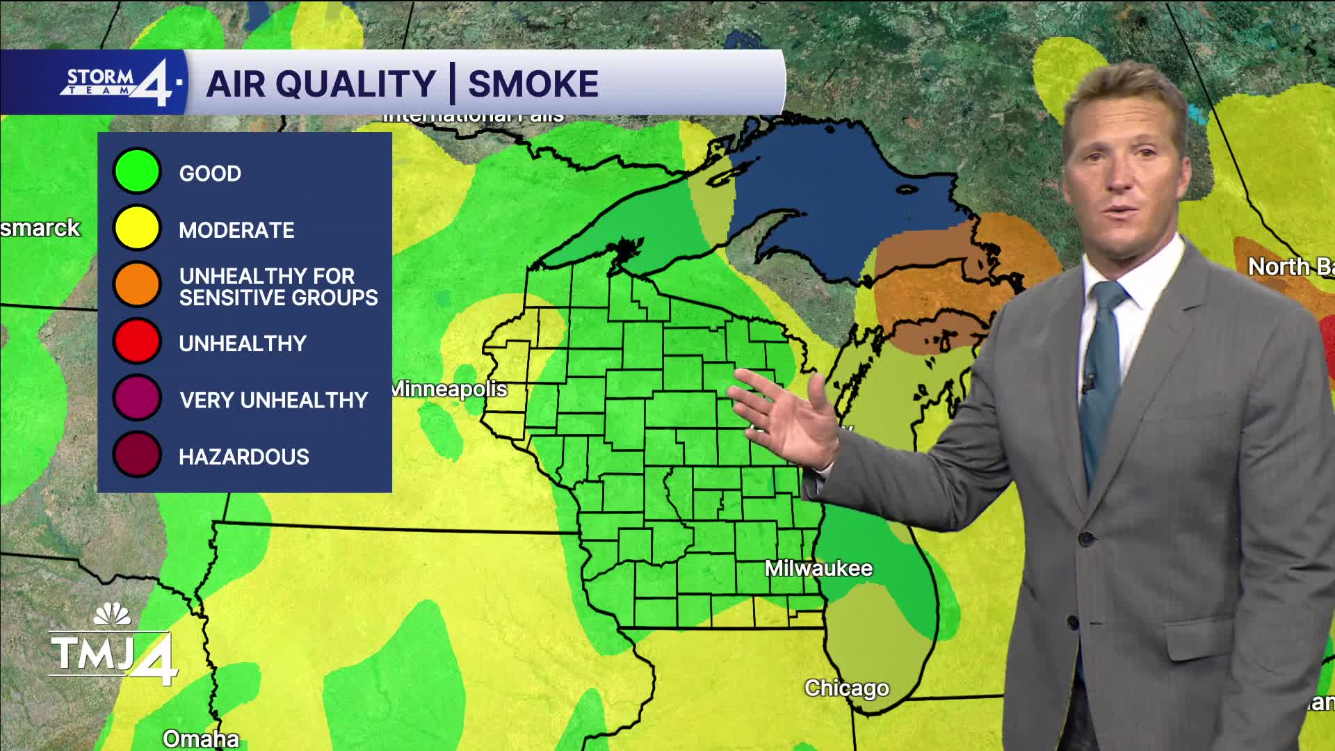
Air quality advisory until noon Thursday - we are tracking wildfire smoke that will likely impact the area Wednesday night (you should be able to smell it as a cold front mixes it down to the surface). We will be in the unhealthy for sensitive groups category - ORANGE.
WATCH: How hot it will get and when we may feel some relief
We continue the 90s trend through Saturday.
Rain chances start creeping in Thursday (west - and isolated), Friday a sl. Chance, and Saturday a chance as the HEAT DOME breaks down.
Upper 80s Sunday and Monday...with dropping dews.
***A HEAT ADVISORY HAS BEEN ISSUED FOR ALL OF SOUTHEASTERN WISCONSIN FROM 12P TUESDAY THRU 8P WEDNESDAY***
WEDNESDAY: Heat advisory until 8pm. Hot and humid
High: 95
Wind: NW/NE 5-10
THURSDAY: hot and humid, chance of a pop up t'storm west
High: 90
Wind: NE 5-10
FRIDAY: Partly cloudy - chance of storms
High: 90
Wind: E 5-10
SATURDAY: Mostly sunny...chance of storms
High: 93
Wind: SW/NW 5-10
SUNDAY: Mostly sunny, muggy
High: 87
Wind: NE 10-15
MONDAY : Partly cloudy, sl chance
High: 88
Wind: NW 5-10
TUESDAY: Less muggy, partly cloudy
High: 83
It’s about time to watch on your time. Stream local news and weather 24/7 by searching for “TMJ4” on your device.
Available for download on Roku, Apple TV, Amazon Fire TV, and more.
