
Clear skies continue tonight before a cold front drops in from the NW later Saturday. Scattered showers and thunderstorms are expected.
The Storm Prediction Center (SPC) has placed a Marginal (Level 1) risk of severe weather over much of Wisconsin.
The strongest storms will be capable of producing gusty winds and hail. This will not be a big severe weather event though.
Watch: When more storms are expected
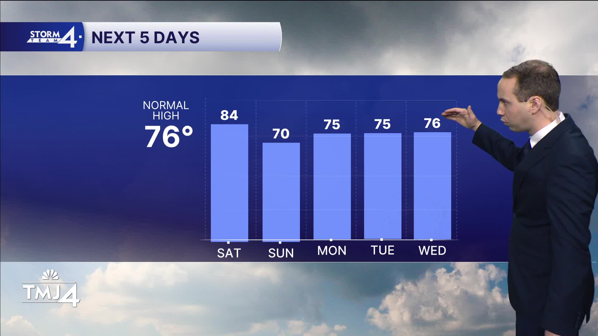
Cooler weather moves in for Sunday. Highs remain in the 70s through much of next week.
A few rounds of showers/storms are expected Tuesday and Wednesday.
TONIGHT: Mainly Clear
Lows: 62
Wind: SW 5-10 mph
SATURDAY: Partly Cloudy; PM Storms Likely
High: 84
Wind: SW 5-15 MPH
SUNDAY: Mostly Sunny and Breezy
High: 70
MONDAY: Mostly Sunny
High: 75
TUESDAY: Partly Cloudy; Chance Showers/Storms
High: 75
WEDNESDAY: Showers/Storms Likely
High: 76
It’s about time to watch on your time. Stream local news and weather 24/7 by searching for “TMJ4” on your device.
Available for download on Roku, Apple TV, Amazon Fire TV, and more.
