

The cold doesn't feel as bad when the wind is lighter and the sun is shining. Still plan to bundle up with low temperatures will still fall close to zero tonight. The wind chill will be as low as -10.
Watch: How much warmer it will get this weekend
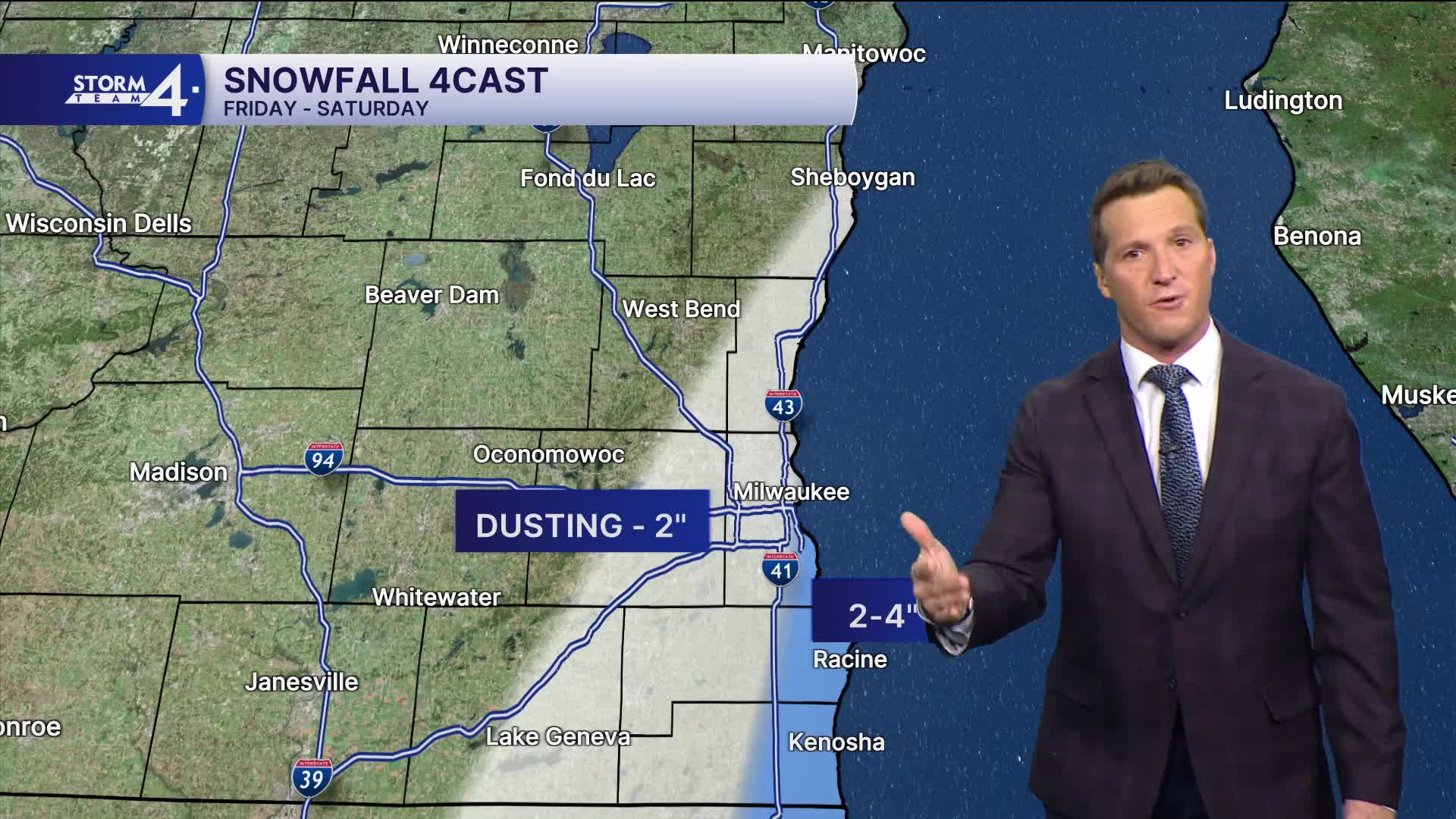
The main forecast focus lies on the potential for lake effect snow Friday and now potentially Saturday. As the wind shifts slightly northeast, a band of lake effect snow should come onshore tomorrow morning.
There is a small chance it initially comes ashore north of Milwaukee early in the morning, then progresses its way south through midday, wrapping up in the afternoon.
Around 2-4" of snow is possible from Milwaukee to Kenosha, with lighter amounts north and west.
Computer models are hinting at a return of lake effect snow on Saturday, with some additional accumulation possible.
HERE'S YOUR LATEST STORM TEAM WEATHER FORECAST FOR MILWAUKEE
AND SOUTHEASTERN WISCONSIN BY METEOROLOGIST BRIAN NIZNANSKY
TONIGHT: Partly Cloudy
Lows: 4
Wind: NW 5-10 mph
FRIDAY: Lake Effect Snow Likely. 2-4" Lakeside MKE and south. Less NW.
High: 16
Wind: N 10-15 mph
SATURDAY: Partly Cloudy. Ch. Lake Snow. Some Additional Accumulation Possible
High: 23
SUNDAY: Partly Cloudy with Ch. Light Snow Late
High: 26
MONDAY: Partly Cloudy
High: 28
It’s about time to watch on your time. Stream local news and weather 24/7 by searching for “TMJ4” on your device.
Available for download on Roku, Apple TV, Amazon Fire TV, and more.
