

As very cold air aloft spills in from the north, pop-up sleet and snow showers are possible this evening. Very little or no snow accumulation is expected, but don't be surprised to experience a brief but intense burst of frozen precipitation.
As skies clear, lows tonight eventually fall into the 20s. A cold but sunny day is on the way for Tuesday.
WATCH: Southeast Wisconsin weather: Chilly start to the week
Active weather continues this week with multiple rounds of rain. The next chance is a brief round of rain and snow possible on Wednesday morning, followed by better chances for rain on Wednesday and Thursday night.
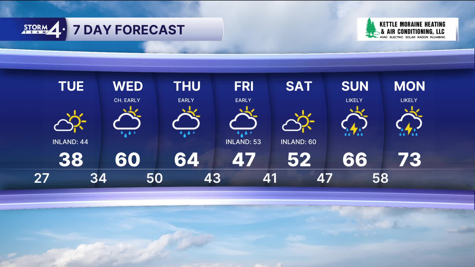
TONIGHT: Sct'd Sleet/Snow Showers Early and Chilly
Low: 27
Wind: N 10 mph
TUESDAY: Mostly Sunny and Chilly
High: 38 Lake 44 Inland
Wind: N to E 5 mph
WEDNESDAY: Ch. Wintry Mix Early then Partly Cloudy and Warmer
High: 60
THURSDAY: Early Morning Rain and Mild
High: 64
FRIDAY: More Morning Rain and Mostly Cloudy
High: 47 Lake 53 Inland
It’s about time to watch on your time. Stream local news and weather 24/7 by searching for “TMJ4” on your device.
Available for download on Roku, Apple TV, Amazon Fire TV, and more.
