

What a beautiful, sunny, warm day! Everyone saw 70 degrees today, even if it was just for an hour or so. Temperatures are rapidly falling near the lake this evening.
Now we turn our attention to the chance for thunderstorms tonight. We are mainly monitoring storms along a warm front as they push into Southeast Wisconsin. The main impact would be hail, ping pong-sized at the largest. We expect these storms south of 94 and from 9 p.m. to 1 a.m.
WATCH: Southeast Wisconsin weather: Big temperature swings
I expect a lull in precipitation into the morning hours. We could see more thunderstorms Tuesday afternoon and evening.
Highs will be in the upper 60s. As a cold front drops in from the North, showers/storms fire off over Wisconsin. There is a good deal of uncertainty as to the coverage of any storms Tuesday morning.
Temperatures plummet Tuesday night, falling to 32 overnight and starting April below average, in the low 40s. (Not joking)
Cloudy skies and storm chances continue into the weekend. We may even see some mixed precipitation on Thursday.
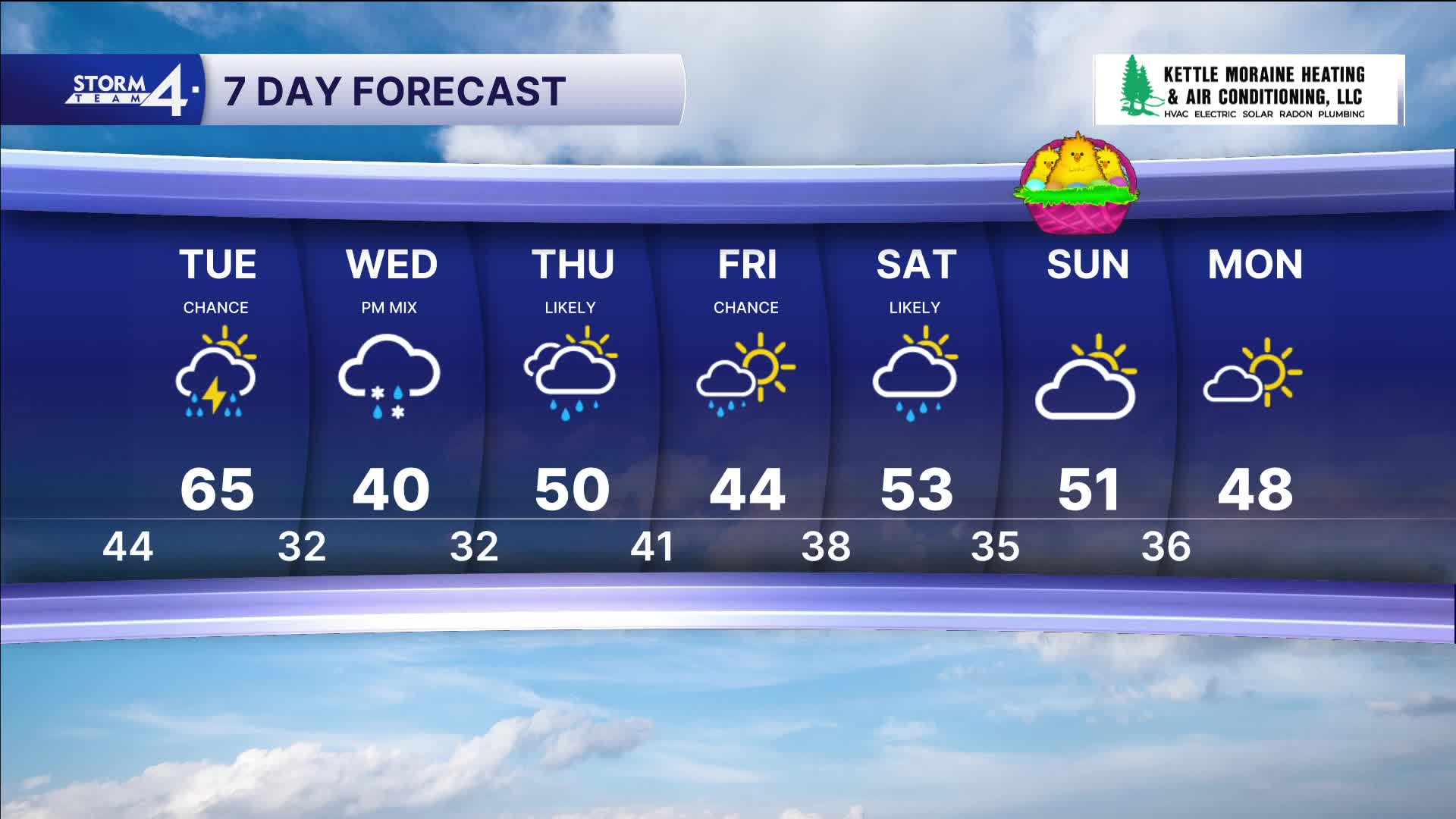
TONIGHT: Chance Rain/Storms; Mostly Cloudy
Low: 44
Wind: NE 5-10 mph
TUESDAY: Warm, Chance Storms
High: 65
Wind: NW 5-15 mph
WEDNESDAY: Mostly Cloudy & Cool; Chance PM Rain/Snow Mix
High: 40
Wind: NE 10-20 mph
THURSDAY: Rain Likely; Windy
High: 50
FRIDAY: Slight Chance Rain; Mostly Cloudy
High: 44
SATURDAY: Rain Showers Likely
High: 53
It’s about time to watch on your time. Stream local news and weather 24/7 by searching for “TMJ4” on your device.
Available for download on Roku, Apple TV, Amazon Fire TV, and more.
