

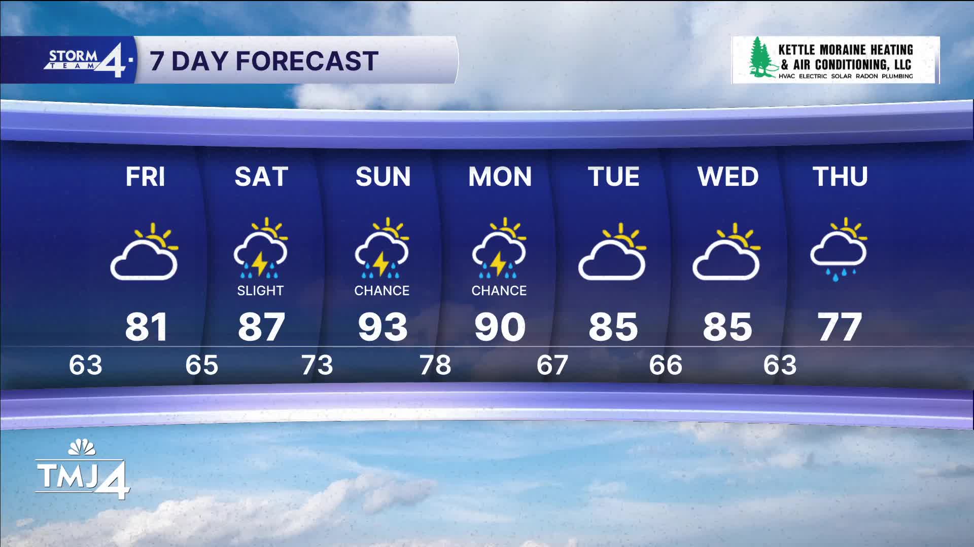


It's a little warmer today but still quite comfortable for the middle of July. Drought conditions continue to worsen, with little to no rain on the way for the next few days.
Skies will be partly cloudy tonight with lows around 60 degrees.
Temperatures and humidity trend up into the weekend. By Sunday, we likely reach the 90s, and higher humidity will make it feel close to 100 degrees.
WATCH: When the 90s return
The big question is when rain returns to southeast Wisconsin. There is a small chance for storms Saturday night, with a little better chance Sunday and Monday. These rain chances are far from guarantees.
TONIGHT: Partly Cloudy
Lows: 63
Wind: S 5-10 mph
FRIDAY: Partly Cloudy and A Little Warmer
High: 81
Wind: SE 10-15 mph
SATURDAY: Partly Cloudy, Warm, and Humid. Slight Ch. Storms Late
High: 87
SUNDAY: Hot and Humid with Ch. T-Storms
High: 93
Heat Index: Near 100
MONDAY: Partly Cloudy, Hot, Humid. Ch. T-Storms
High: 90
Heat Index: Near 100
It’s about time to watch on your time. Stream local news and weather 24/7 by searching for “TMJ4” on your device.
Available for download on Roku, Apple TV, Amazon Fire TV, and more.
