

We did it! We made it through the coldest 2 days in 300 days! Today was warmer with highs in the teens but at least we are above 0!
Tomorrow we will climb above freezing! Many of us will see highs in the upper 30s! We can expect a mix of sun and clouds with gusty southerly winds.
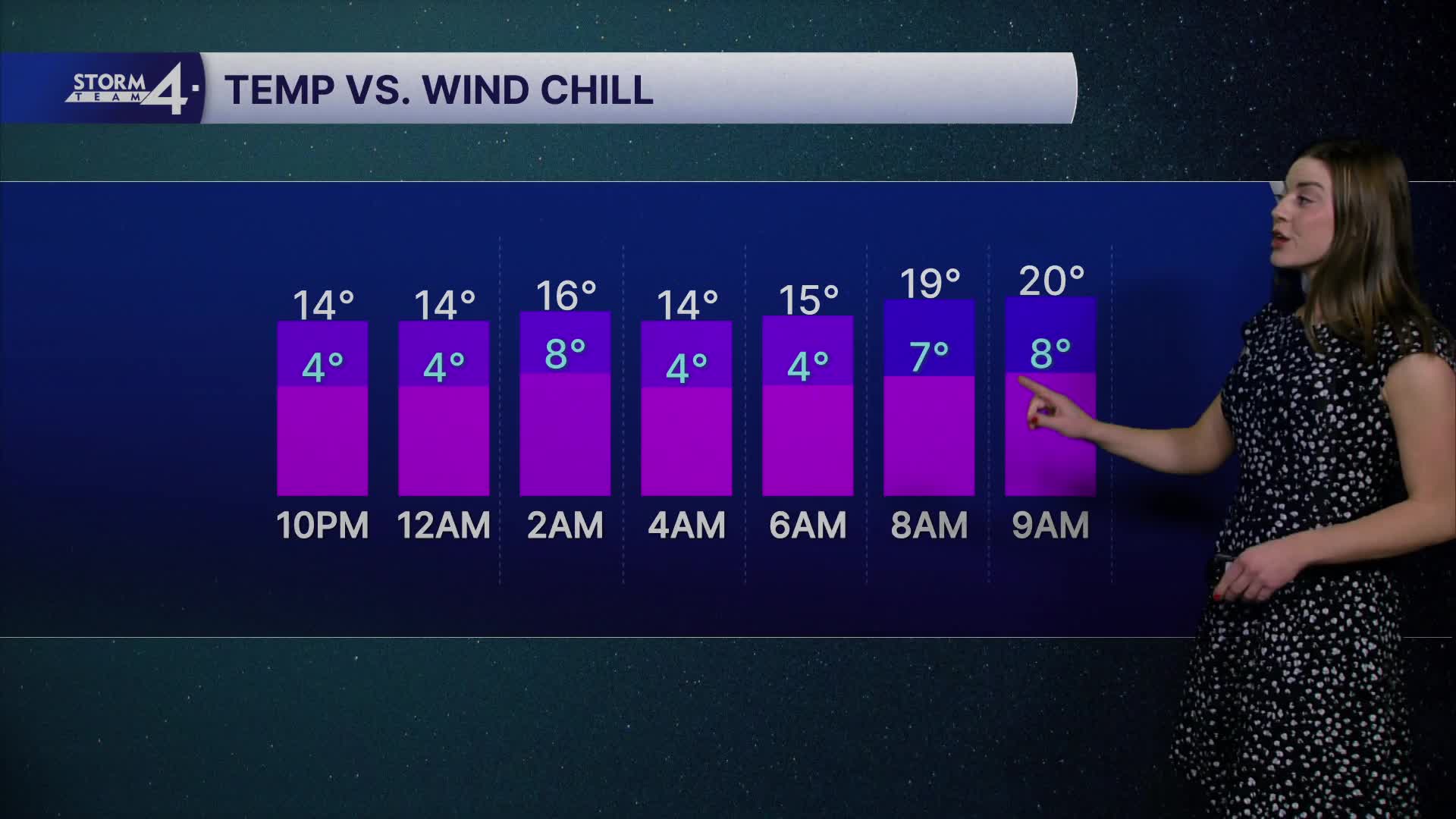
Watch: How warm will it get?
We get even warmer this week, you with highs to near 40 for Wednesday and Thursday.
There will be a low-pressure system tracking through the Upper Midwest, bringing us rain overnight Wednesday into Thursday. As we get into Thursday evening, we may see a few flurries.
The milder temps stick around into next weekend.
There aren't any real snow systems headed our way! Feel free to hang up the shovel for a bit! Storm Team 4 will monitor your chances for a white Christmas.
TONIGHT: Partly Cloudy
Low: 13
Wind: W 10-15 mph
TUESDAY: Mostly Sunny
High: 36
Wind: SW 5-15 mph
WEDNESDAY: Cloudy, Chance for Showers Late
High: 36
THURSDAY: Chance for Showers, Some Flakes
High: 41
FRIDAY: Partly Cloudy
High: 27
Saturday: Mostly Sunny
High: 38
It’s about time to watch on your time. Stream local news and weather 24/7 by searching for “TMJ4” on your device.
Available for download on Roku, Apple TV, Amazon Fire TV, and more.
