
It's been another fantastic day with a summer feel. It was actually our warmest day in Milwaukee since August 22!
Another mild night is expected tonight with temperatures and dewpoints around 60.
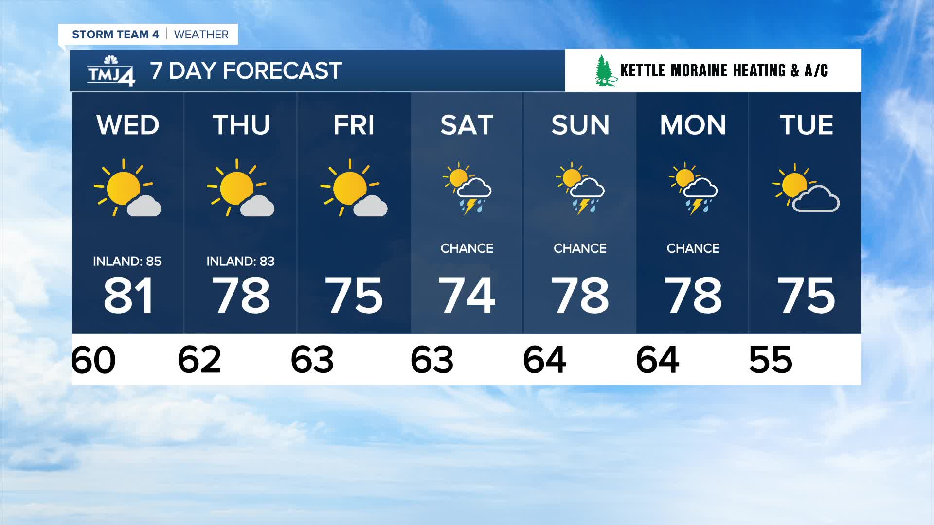
Watch out for a few pockets of low-lying fog starting this evening through tomorrow morning. We'll make another run at 80 degrees tomorrow, then the end of the week will be slightly cooler.
Watch: When we could see some scattered showers
High pressure finally breaks down this weekend, opening up the chance for scattered showers and storms this weekend.
TONIGHT: Mainly Clear. Patchy Fog
Low: 60
Wind: Calm
WEDNESDAY: Mostly Sunny
High: 81 Lake 85 Inland
Wind: SE 5 mph
THURSDAY: Mostly Sunny
High: 78 Lake 83 Inland
FRIDAY: Mostly Sunny
High: 75
SATURDAY: Partly Cloudy. Ch. Showers/Storms
High: 74
It’s about time to watch on your time. Stream local news and weather 24/7 by searching for “TMJ4” on your device.
Available for download on Roku, Apple TV, Amazon Fire TV, and more.
