

This afternoon is about as nice as it gets for us in January. Sunshine broke out in full force, and temperatures climbed into the 40s. We'll stay dry and mild tonight with lows in the 30s.
Watch: When the next chance of rain and snow arrives
The next storm system will bring rain to the area by tomorrow afternoon. As the area of low pressure intensifies and crosses right over southern Wisconsin, we may find ourselves in the warm sector dry slot. If this happens, we may soar well into the 50s in the evening, which would be near record territory.
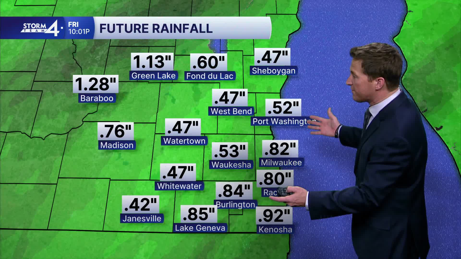
Thunderstorms may also be possible Friday evening if we enter the warm sector of low pressure. Around a half inch of rain is likely, but more is possible northwest of Milwaukee.
HERE'S YOUR LATEST STORM TEAM WEATHER FORECAST FOR MILWAUKEE
AND SOUTHEASTERN WISCONSIN BY METEOROLOGIST BRENDAN JOHNSON
WEDNESDAY: Early Patchy Fog; Becoming Partly Cloudy
High: 40
Wind: W to S 10 mph
TONIGHT: Partly Cloudy
Low: 36
Wind: S 5 mph
THURSDAY: Increasing Clouds; Mild with PM Rain
High: 51
FRIDAY: Early Rain; Then Patchy Drizzle & Cloudy
High: 43
SATURDAY: Chance Rain/Snow Mix
High: 36
SUNDAY: Slight Chance AM Flurry; Partly Cloudy
High: 28
It’s about time to watch on your time. Stream local news and weather 24/7 by searching for “TMJ4” on your device.
Available for download on Roku, Apple TV, Amazon Fire TV, and more.
