
It’s been another day of blue skies and sunshine across SE Wisconsin. We have also had another afternoon with a wide range of temperatures, from 60s near the lake to 80s inland. More tranquil conditions can be expected for tonight with mostly clear skies and lows in the 50s. On Monday, breezy southerly winds and abundant sunshine will help to warm the entire area into the 80s. We are currently still on track to see the remnants of T.S. Cristobal bring wind and rain into our area on Tuesday afternoon. Along with the rain, gusty winds up to 40 mph and thunderstorms will be possible.
In addition to Cristobal, we will also be tracking a strong area of low pressure moving out of the central Plains on Tuesday, that will likely interact with the remnants of Cristobal increasing shower and thunderstorm chances for Wednesday. Highs on Tuesday and Wednesday will top out in the 70s. Thursday & Friday will be mostly sunny and breezy with highs in the upper 60s and lower 70s.
HERE'S YOUR LATEST STORM TEAM WEATHER FORECAST FOR MILWAUKEE
AND SOUTHEASTERN WISCONSIN BY ELISSIA WILSON
TONIGHT: Mostly clear.
Low: 57
Wind: NE 5-10 mph
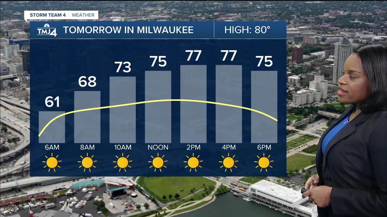
MONDAY: Sunny, breezy & warm.
High: 80
Wind: S 5-15 mph
TUESDAY: Partly sunny AM then showers & thunderstorms likely in the afternoon.
High: 77
WEDNESDAY: Cloudy & windy with sct. showers & thunderstorms.
High: 75
THURSDAY: Mostly sunny & breezy.
High: 75
