

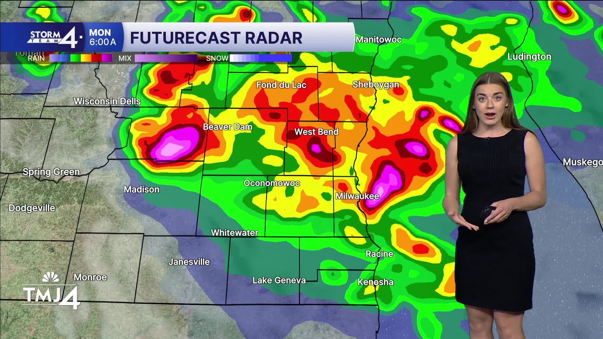


It is hot today with highs in the upper 80s and low 90s. Heat index values reach triple digits away from the lake. The Heat Advisory remains in effect until 9P Sunday.
We desperately need rain as drought conditions continue across the state. There is a chance for thunderstorms overnight. The Storm Prediction Center has ALL of Wisconsin in a level 3 (enhanced) risk overnight. Wind and hail are the main threats with this system.
Storms are possible again Monday night but depend on what happens here overnight. Again, the SPC has SE Wisconsin in a level 2 (slight) risk. Monday is hot and humid with temperatures in the upper 80s and feels like temps in the 90s. We may see another Heat Advisory be issued.
Tuesday and Wednesday will be more comfortable with temperatures close to normal.
WATCH: When showers and storms could offer some drought relief
HERE'S YOUR LATEST STORM TEAM WEATHER FORECAST FOR MILWAUKEE
AND SOUTHEASTERN WISCONSIN BY METEOROLOGIST LAUREN LARSEN
TONIGHT: Storms Likely
Low: 72
Wind: SW 5-10 mph
MONDAY : Storms Possible Early & Late
High: 87
Wind: W 10-15 mph
TUESDAY: Clouds Decrease
High: 80
Wind: N 5-10 MPH
WEDNESDAY: Mostly Sunny
High: 82
THURSDAY: Chance Showers
High: 82
FRIDAY: Chance Showers
High: 80
It’s about time to watch on your time. Stream local news and weather 24/7 by searching for “TMJ4” on your device.
Available for download on Roku, Apple TV, Amazon Fire TV, and more.
