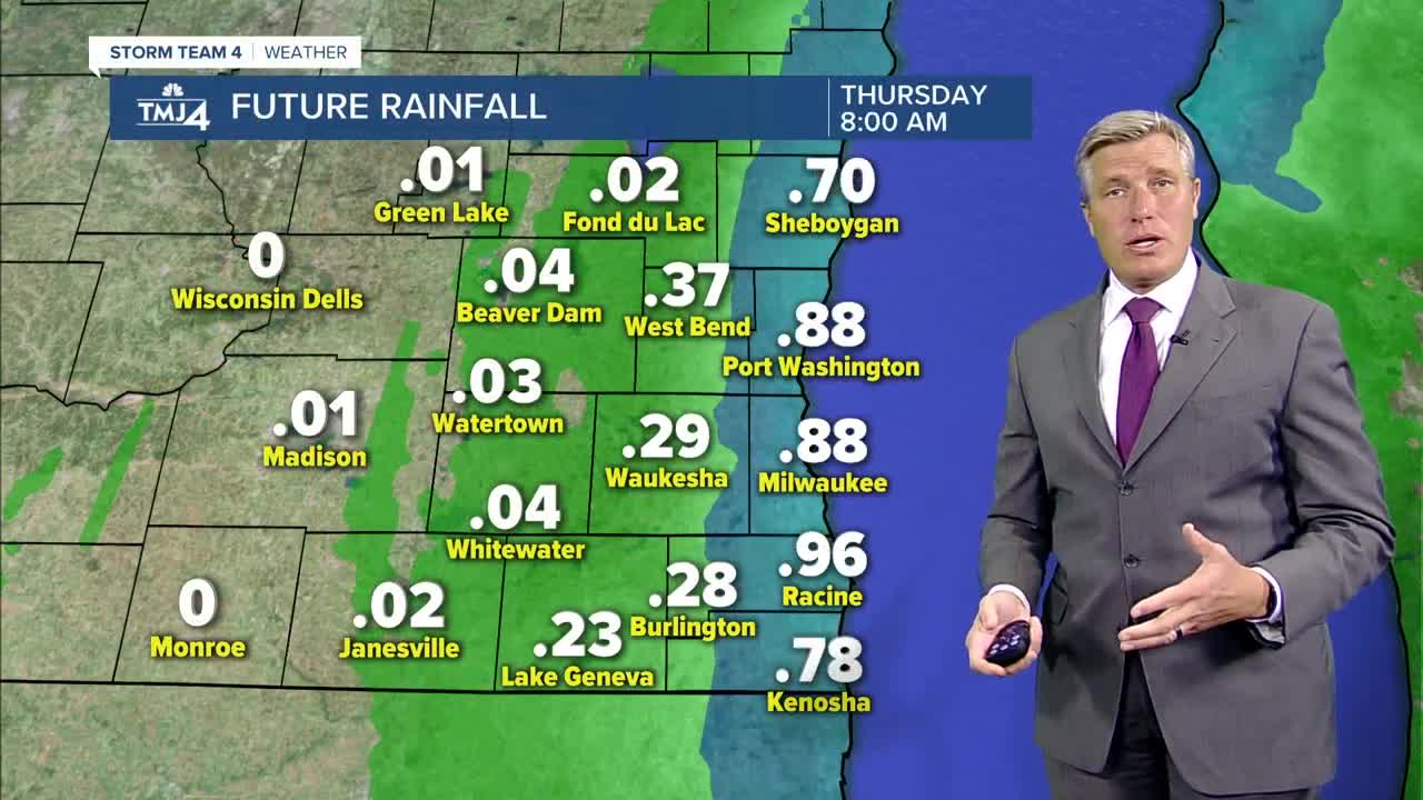


Last night's heavy rain created flooding in Racine, Kenosha and Walworth counties, and soaking rains elsewhere. Milwaukee got 1" of rain, but some areas have received 2-4"+ of rain in the past 24 hours, and the showers are expected to continue tonight and early Thursday.
As a result, a Flood Watch is in effect until midnight for Milwaukee, Waukesha, Racine, Kenosha and Walworth counties. Another inch or more of rain is expected through tonight and will cause some flooding. In addition to the rain, tonight is foggy and windy with NW winds to 40 mph. Low temps will be in the lower 40s.
The rain and wind continues into midday Thursday with NW winds of 20-35 mph. Inland areas will see some sun in the afternoon with highs near 60 while the lakefront is in the upper 40s . Friday is sunny and nice with a light breeze and a high in the upper 50s in Milwaukee to mid 60s inland. Saturday is beautiful with sun, a few clouds, a light SW wind and highs near 70.
******FLOOD WATCH FOR MILWAUKEE, WAUKESHA, RACINE, KENOSHA, WALWORTH COUNTIES UNTIL 6AM THURSDAY*********
TONIGHT: Cloudy, windy and foggy with showers likely.
Low: 43
Wind: NW 20-40 mph
THURSDAY: Scattered AM showers, then mostly cloudy and windy...sunny inland
High: 49 Lakefront...58 Inland
Wind: NNW 20-35 mph
FRIDAY: Mostly sunny and nice
High: 54 Lakefront...64 Inland
Wind: NNE 5-10 mph
SATURDAY: Mostly sunny and beautiful
High: 62 Lakefront...72 inland
Wind: SW 5-10 mph
SUNDAY: Mostly sunny and mild with a spotty afternoon shower
High: 58 Lakefront…66 Inland
Wind: NW 5-15 mph
MONDAY: Partly cloudy with a cool breeze
High: 51 Lakefront...66 Inland
Wind: NE 5-15 mph
