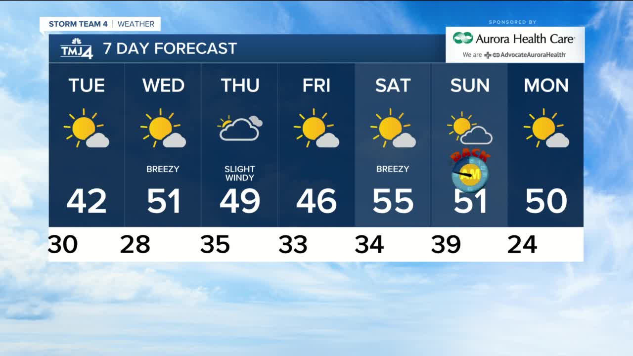


Sunday had our first snow and some of us had more flurries this morning which thankfully left the area quickly. Unfortunately, we have been stuck with the clouds all day, highs in the 30s and wind chills in the 20s. Our normal high is 56 and we stay below that all week.
Tonight has a few clouds with lows near 30 in Milwaukee to mid 20s inland. A few stubborn morning clouds will clear out and we get to enjoy the sun on Tuesday, but it will be chilly with highs in the lower 40s.
Wednesday is sunny and breezy but we warm into the lower 50s with that SW breeze at 20 mph. Thursday is the only other day with a chance for rain and it is very isolated. Otherwise, it is mostly cloudy with highs in the 40s and a NE wind to 25 mph. Friday is sunny and 46, and we finally get back to normal on Saturday with a high of 55 and sunshine. Sunday's high is 51. Don't forget that we fall back this weekend and we get an extra hour of sleep on Saturday night.
TONIGHT: Mostly cloudy and frosty
Low: 31 Lakefront...24 Inland
Wind: NW 5-10 mph
TUESDAY: Cloudy early, then clearing and chilly
High: 42
Wind: W 5-15 mph
WEDNESDAY: Mostly sunny and breezy
High: 51
Wind: SW 15-20 mph
THURSDAY: Mostly cloudy and windy with isolated shower
High: 49
Wind: NE 15-25 mph
FRIDAY: Mostly sunny and chilly
High: 46
Wind: N 5-10 mph
SATURDAY: Mostly sunny, breezy and nice
High: 55
Wind: SW 15-20 mph
