

High temperatures across Southeast Wisconsin were only in the 20s for the third day in a row.
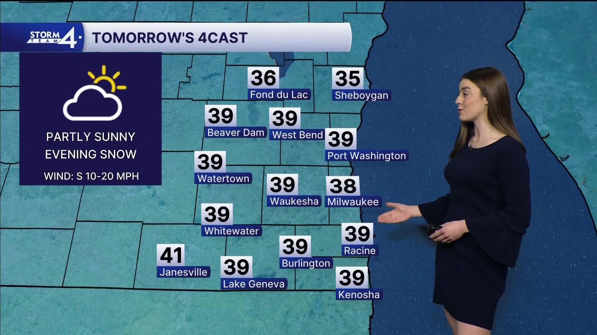
Our overnight lows fall back into the teens as more cloud cover moves in. Tomorrow will be warmer as southerly winds boost our temperatures into the upper 30s!
A clipper system brings a chance for snow Tuesday evening. Snow showers may impact the evening commute. Accumulations will remain under an inch. Newer models this afternoon are suggesting accumulations less than ¼ inch.
Watch: When will it warm up again?
Sunshine returns on Wednesday, with highs in the upper 20s. Another area of low-pressure moves by the southwest late Wednesday into Thursday. A few snow showers may clip areas SW of Milwaukee; however, Storm Team 4 has been tracking the system, and it is likely to pass south of Wisconsin.
A burst of warm air is expected by Friday as highs climb toward 50!
TONIGHT: Mostly Cloudy
Low: 18
Wind: NW 10-20 mph
MONDAY: Partly Cloudy and Breezy
High: 27
Wind: NW 5-15 mph
TUESDAY: Ch. Light Snow Evening
High: 38
Wind: S 10-20
WEDNESDAY: Partly Cloudy, Chance Mix
High: 32
THURSDAY: Mostly Cloudy, Chance Mix
High: 36
FRIDAY: Mostly Sunny
High: 45
FRIDAY: Mostly Sunny
High: 50
It’s about time to watch on your time. Stream local news and weather 24/7 by searching for “TMJ4” on your device.
Available for download on Roku, Apple TV, Amazon Fire TV, and more.
