

It has been a beautiful day with highs near 80, lots of sun and low humidity. You can enjoy that great weather this evening and not have to worry about downpours like the past few evenings. The sky stays clear and temps will be in the 70s this evening.
Tonight is clear and comfortable with a low of 64, but things change quickly on Friday with a warm front. SW winds will increase to 25 mph and being in heat and high humidity. High temps will be in the upper 80s and it will be sticky.
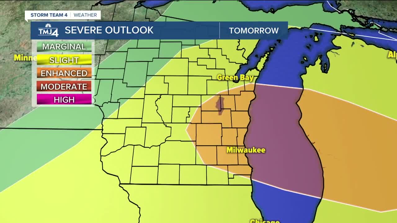
A cold front will then fire up a line of severe storms in the afternoon and evening. We are under an ENHANCED RISK for severe storms tomorrow with the prime threat being between 4pm and 8pm. Showers will continue until midnight and be out of here before Saturday morning.
Saturday is sunny, humid and warm with a high of 82 in Milwaukee to upper 80s inland.
Sunday is mostly sunny and warm with a high of 76 lakefront to 85 inland. There is a slight chance for a pop up afternoon shower. The humid and warm weather continues all next week with highs in the 80s and scattered afternoon t'torms...summer is here.
TONIGHT: Mostly clear and nice
Low: 64
Wind: SW 5-10 mph
FRIDAY: Partly cloudy, hot and humid with severe t'storms likely after 4pm
High: 88
Wind: SW 15-25 mph
SATURDAY: Mostly sunny, warm and humid
High: 78 Lakefront...87 Inland
Wind: NW 5-10 mph
SUNDAY: Partly cloudy and humid with a few afternoon t'showers
High: 76 Lakefront...85 Inland
Wind: SE 5-10 mph
MONDAY: Partly cloudy and humid with scattered t'showers
High: 79 Lakefront...87 Inland
Wind: SE 5-10 mph
TUESDAY: Partly cloudy, warm and humid with scattered t'showers
High: 79 Lakefront...88 Inland
Wind: SE 5-10 mph
