


Lake effect snow is very common in the Great Lakes region during the winter months, especially to the east and southeast of the lakes.
Lake effect snow, however, is less common in southeast Wisconsin, especially the snowfall amounts we saw on Tuesday, February 16. So, what happened?
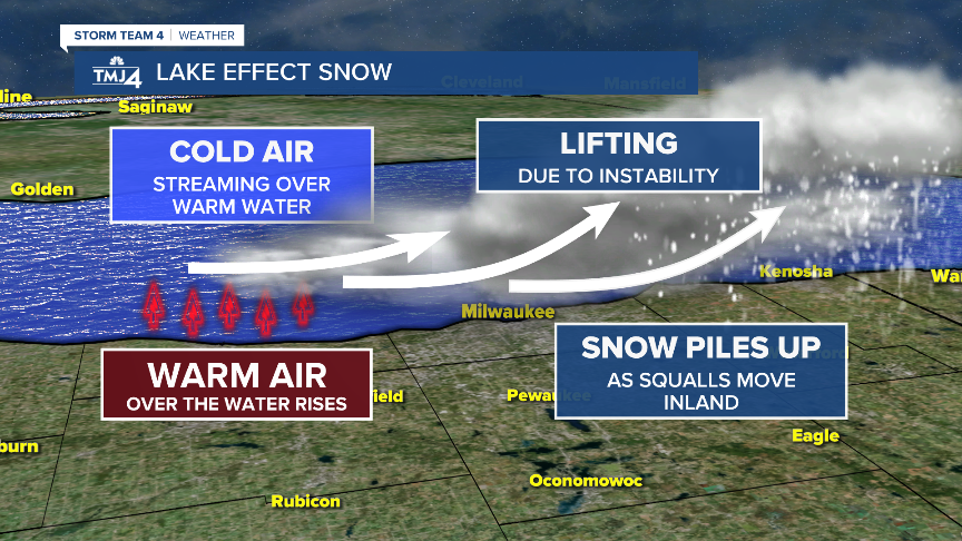
Well, the perfect scenario happened. A north-northeasterly wind developed across Lake Michigan and southeast Wisconsin as a storm moved through the Ohio River Valley. Cold air, which was in the single digits, moved across an unfrozen and relatively warm Lake Michigan, which was around 35°.

As the cold air moved across the warmer lake, the warmth and moisture from the lake was transferred into the air. The air rose to form clouds, which grew into a narrow, yet long, band of clouds that extended into southeast Wisconsin. As the band moved inland, the cold air could no longer support the high levels of moisture and it precipitated out as snow.
Early Tuesday morning with the perfect north-northeasterly wind across Lake Michigan, long bands of Lake Effect Snow developed. Most locations along the lakefront picked up 3-5" of snow.

But one band in particular stayed in relatively the same spot for more than 6 hours. With snowfall rates around 2" and hour at times, from Downtown Milwaukee to Kenosha County more than a foot of snow fell.


