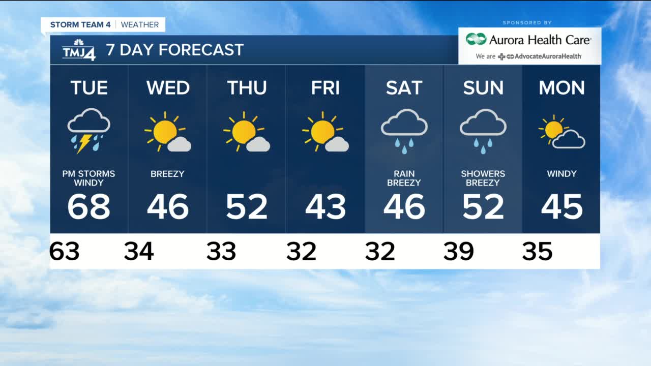


After seven days of incredible record-breaking temps, the weather is about to change and we get back to reality. Today's high was a record 76 with the strong SW winds to 35 mph. The breeze stays at 15-20 mph tonight and with the cloud moving in, our lows are near 60...the normal high is 50. It is a warm night and Tuesday remains very warm with highs in the upper 60s, but it is cloudy and windy with scattered showers starting after 6 a.m. and throughout the day. The best chance for rain is from 4 p.m. until 7 p.m. and there will be downpours and rumbles of thunder. We could see about 1" of rain across the area...our first rain in 17 days.
The cold front arrives Tuesday evening and temps drop rapidly into the low 30s by Wednesday morning. Wednesday is sunny and breezy, but highs will only be in the mid-40s. Thursday is sunny and pleasant with a high of 52. Another front brings highs in the low 40s for Friday, and Saturday is cloudy, breezy and rainy with highs in the mid-40s. Sunday will be in the low 50s but scattered showers will continue.
TONIGHT: Mostly cloudy and warm
Low: 63
Wind: SW 10-15 mph
TUESDAY: Cloudy and windy with rain likely and scattered t'showers in afternoon
High: 68
Wind: SW 20-35 gusts to 40 mph
WEDNESDAY: Mostly sunny, breezy and colder
High: 46
Wind: W 15-20 mph
THURSDAY: Mostly sunny and pleasant
High: 52
Wind: SW 10-15 mph
FRIDAY: Mostly sunny and chilly
High: 43
Wind: NW 10-15 mph
SATURDAY: Cloudy and chilly with rain likely
High: 46
Wind: SE 10-20 mph
